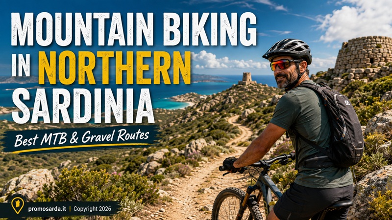
15 mountain bike, gravel and e-MTB rides from Alghero and Stintino to Asinara, Monte Limbara, Santa Teresa, La Maddalena and Caprera — with archaeology, wildlife, local history and practical advice
My name is Gavino. I am from Nuoro and mountain biking is probably the outdoor activity I practise most consistently. I hike a lot too, I ride horses reasonably well, and I have occasionally tried downhill. Occasionally is the important word. I enjoy a technical descent. I do not need every Sunday morning to become a negotiation with an orthopaedic surgeon.
Northern Sardinia is very good for bikes because the terrain changes quickly. Around Alghero you have limestone, pine forest, old military tracks and relatively friendly dirt roads. Around Stintino the riding becomes open, windy and coastal. Asinara gives you one of Sardinia’s strangest combinations of cycling, wildlife and prison history. Gallura changes everything again: granite, cork oak, abandoned railway infrastructure, stazzi and proper climbing. Then La Maddalena and Caprera combine asphalt, dirt tracks, military roads and island scenery.
What Northern Sardinia does not have is one perfectly standardised MTB network where every track you find on an app is maintained, signposted and legally rideable.
So I check.
That is part of biking.
A trail being physically possible on two wheels does not automatically mean bicycles are currently permitted there.
I am The Outdoor Guide of this website, not a professional mountain-bike guide taking paying clients. Where interpretation, navigation, technical instruction or access conditions justify professional assistance, I recommend people who actually provide that service.
15 Northern Sardinia MTB & Gravel Routes at a Glance
| Route | Area | Distance | Best bike | My level | Main reason to ride |
|---|---|---|---|---|---|
| Riviera del Corallo / Porto Conte | Alghero | Flexible / ~3.5 h guided format | e-MTB / MTB | Easy–moderate | Palmavera + WWII + coast |
| Monte Timidone–Cala Barca | Porto Conte | ~3.5 h outing | MTB / e-MTB | Moderate | Wildlife + summit |
| Lago di Baratz + Porto Ferro | Nurra | 6.4 km + optional 2.8 km link | MTB / gravel | Easy–moderate | Lake + dunes + forest |
| Villanova–Nuraghe Appiu E303 | Villanova Monteleone | 9.4 km one way | MTB / e-MTB | Moderate | Best archaeological ride |
| Stintino–Le Saline | Stintino | 4.1 km one way | gravel / trekking / e-bike | Easy | Coast + tonnara landscape |
| Strada del Falcone | Stintino | 2.2 km one way | MTB / e-MTB | Easy–moderate | Capo Falcone viewpoint |
| Coscia di Donna–Isola dei Porri | Stintino | ~3 km | MTB | Moderate | Wild west coast |
| Water Trail | Asinara | 6.9 km | MTB / e-MTB | Easy | Best beginner Asinara loop |
| Granite Trail | Asinara | 11.2 km | MTB / e-MTB | Moderate | Quarries + protected coast |
| Asinara Spine + Memory Trail | Asinara | 25 km spine + 5.5 km loop | gravel / e-bike / MTB | Moderate by distance | History + island crossing |
| Monti–Calangianus–Tempio railway | Gallura | ~34 km to Calangianus + extension | gravel / MTB / e-bike | Moderate | Railway + cork + granite |
| Monte Limbara forest-road ride | Tempio/Berchidda | route-dependent | MTB / e-MTB | Advanced | Proper mountain riding |
| Santa Teresa–Capo Testa | Gallura | ~42.7 km | gravel / e-bike / road | Easy–moderate | Stazzi + Capo Testa |
| La Maddalena Island Loop | La Maddalena | 25.4 km | gravel / MTB / e-bike | Easy–moderate | Best island circuit |
| Caprera Military Roads Ride | Caprera | Flexible | MTB / e-MTB / gravel | Moderate | Garibaldi + forts + granite |
These are not fifteen interchangeable tracks. Some are proper MTB, some are mixed-surface rides where a gravel bike is better, and a few are deliberately easy. I prefer a list where the fifth route is genuinely useful to a normal visitor rather than fifteen supposedly “epic” rides that require 150 mm suspension.
MTB, Gravel or E-MTB?
For Porto Conte, Baratz, Stintino, La Maddalena and the easier Gallura roads, a gravel bike can be an excellent choice if your tyres have sensible volume and you are comfortable on uneven surfaces. For Monte Timidone, the rougher Porto Conte tracks, Villanova–Appiu and Monte Limbara, I prefer an MTB. For Asinara, an e-MTB is extremely useful because distance, wind and heat matter more than technical terrain. A full-suspension bike is unnecessary for most routes in this article; Limbara is where I start appreciating one.
One warning about electric bikes: battery range printed in a catalogue is not your Asinara range. Rider weight, wind, elevation, tyre pressure, surface, temperature and how often you use Turbo all matter.
If your battery display reaches 50% at the point farthest from the ferry, stop congratulating yourself on modern technology.
Turn around.
When Is the Best Time for Mountain Biking in Northern Sardinia?
April, May, June, September, October and early November are my main months. The regional tourism authority similarly recommends spring and autumn for cycling in Sardinian parks, while Santa Teresa’s tourism service identifies roughly the second half of March through June and September to mid-November as its strongest cycling period. (sardegnaturismo.it)
There is one major exception worth repeating because old cycling pages are misleading: Asinara National Park strongly discourages both hiking and biking during the summer months due to intense sun, high temperatures, limited water and lack of shade.
July and August are not forbidden months for every short coastal ride in Northern Sardinia. They are simply the months when I become much more selective.
At 07:00 I am a cyclist.
At 13:30 on an exposed gravel road in August, I am potentially an idiot with a bicycle.
1. Riviera del Corallo — The Alghero Ride I Would Give a First-Time Visitor
Area: Alghero–Fertilia–Porto Conte | Bike: MTB/e-MTB | Allow: around 3–4 hours | Level: easy to moderate with technical variants.
This is not one rigid GPX. It is a Porto Conte circuit linking the cycling corridor out of Alghero with Arenosu, Nuraghe Palmavera, the Porto Conte landscape, Punta Giglio and the old Second World War fortifications.
Porto Conte Regional Park officially opened three dedicated cycling itineraries and states that the wider park can also be explored using its road network and the cycleway running from Alghero towards Nuraghe Palmavera. Casa Gioiosa at Tramariglio has a cycle-tourism service point for minor mechanical work.
The Park’s own guided Riviera del Corallo itinerary starts with roughly five kilometres of cycleway, enters firebreak and pine-forest tracks around Arenosu, reaches the Nuragic complex of Palmavera, climbs through panoramic Porto Conte terrain and then connects the military remains at Punta Giglio with the Mugoni/Lazzaretto coast.
That is exactly how I think a bike route should work.
You pedal.
Then something gives you a reason to stop.
Palmavera is not scenery. It is one of the important Nuragic complexes of north-west Sardinia. Punta Giglio is not merely a viewpoint. Its coastal battery and barracks belong to the twentieth-century defensive landscape.
Gavino’s detour: if you have never visited Palmavera, lock the bike and go inside. Saving twenty minutes by photographing a nuraghe through the fence is not efficiency.
For rentals, Raggi di Sardegna Rent a Bike E-Bike & Tour operates from Via Majorca 119, Alghero, phone +39 334 305 2480, and rents MTB/e-MTB equipment specifically aimed at Porto Conte riding. Another well-reviewed central option is SardiniaByBike at Via Giuseppe Garibaldi 113, phone +39 347 930 6282.
2. Monte Timidone–Cala Barca — The Best Porto Conte MTB Ride
Area: Le Prigionette | Bike: MTB/e-MTB | Level: moderate | Allow: about 3½ hours if you stop properly.
If route one is the complete Alghero introduction, this is the better actual mountain-bike outing.
You begin inside Le Prigionette, climbing on dirt through the protected forest towards Monte Timidone at roughly 400 metres. The reward is a 360-degree view over Porto Conte. The descent then drops towards Cala Barca and the Porticciolo side of the reserve. The Park’s current cycling programme describes the outing as non-challenging overall and family-suitable under guided conditions, but it also specifically includes descent coaching and alternative lines according to technical confidence.
This is also a wildlife ride. Deer, mouflon, donkeys, goats, partridges and especially griffon vultures are part of the wider reserve environment.
I slow down for griffons.
My Strava average has survived.
Gavino wouldn’t do this: chase an animal down a track because you want a closer photograph. Brake. Stop. Let it decide where to go.
3. Lago di Baratz & Porto Ferro — Best Easy Forest Gravel/MTB
Area: Sassari/Nurra | Main loop: 6.4 km | Optional dune connector: 2.8 km | Bike: MTB or robust gravel | Level: easy–moderate.
Lago di Baratz is Sardinia’s only natural freshwater lake and one of my favourite places to introduce somebody to off-road cycling without immediately giving them rocks, cliffs and an identity crisis.
The official E117 Lake Trail is 6.4 km and explicitly lists mountain biking among its permitted activities. Much of the circuit follows dirt trail and forest track around the lake; the current RES status is in review/validation, with warnings including vegetation encroachment and wild boar.
The natural extension is the E117A Dune Trail towards Porto Ferro: another 2.8 km, largely on a forest road around three metres wide through pine forest and Mediterranean vegetation. Sardegna Sentieri notes that it can be ridden easily by MTB as well as travelled on foot or horseback. It too remains in review/validation.
That status is important.
I would ride the lake and dune connector after checking the current RES map.
I would not automatically continue along the entire old coastal Baratz–Le Prigionette combination. Sardegna Sentieri currently warns that the 17.9 km combined itinerary has low validation, insufficient maintenance and access issues caused by fencing on the coastal section.
This is one of the reasons Gavino checks before copying GPX files.
A route that was excellent in 2018 may be irritating in 2026.
4. Villanova Monteleone to Nuraghe Appiu — My Favourite Archaeological MTB Ride
Official trail: E303 | Distance: 9.4 km one way | Elevation gain: 233 m | Bike: MTB/e-MTB | Official MTB grade: MC / Grade 2 | Current status: in review/validation.
This one was made for me.
The official RES catalogue specifically classifies the route for mountain bike, hiking and equestrian tourism and describes it as particularly suitable for bikers. A long dirt road leaves Villanova Monteleone through dry-stone walls, pasture and cork woodland, with broad views towards Capo Caccia and the Nurra. Eagles and griffons can appear overhead.
Then you reach Nuraghe Appiu.
Not “a stone ruin beside the trail”.
The destination.
The last part includes a serious climb around Sas Multitzas/Su Paris before reaching the archaeological complex. The official route is one-way, so either return the same way or arrange the logistics properly.
There is also the E303A link towards Monte Minerva, another 5 km MTB-rated section through holm oak and cork woodland, allowing experienced route planners to extend the day.
Gavino’s archaeology rule: if you find an object that genuinely appears archaeological, do not put it into a jersey pocket. Italian cultural-heritage law requires a fortuitous archaeological discovery to be reported within 24 hours to the competent Soprintendenza, the Mayor or public-security authorities, normally leaving it in the condition and location where it was found.
A bicycle is useful for reaching archaeology.
It is not useful for removing archaeology.
5. Stintino to Le Saline — The Route for People Who Say They “Don’t Mountain Bike”
Distance: 4.1 km one way | Bike: gravel, trekking, e-bike, MTB | Level: easy.
Start around the Museo della Tonnara and head south.
The official Stintino cycling path follows the coastal area before moving slightly inland beside the SP34 and reaches Le Saline. The route is about 4.1 km and almost completely flat.
Is this mountain biking?
No.
And I refuse to pretend otherwise because SEO says MTB.
It is a very useful mixed-surface/easy cycling route and an excellent family outing.
The cultural connection is more interesting than the technical one: begin with Stintino’s tuna-fishing heritage, ride through the landscape that developed around the village and finish near the salt-pan environment and long beach.
For local bike support, Excursio Outdoor operates from Via Sassari, Stintino, phone +39 379 307 4042, with bike rental among its services. Another well-reviewed cycling option is Stinbike ASD Sporting Club, Via Sassari, Stintino, phone +39 333 136 6101.
6. Strada del Falcone — Short Climb, Serious View
Distance: 2.2 km one way | Bike: MTB/e-MTB | Level: easy–moderate.
From the road towards Isola Piana, Via della Torre leads to the unpaved Strada del Falcone. Motor vehicles are stopped by a barrier higher up, but the official tourism service states that the route continues on foot or bicycle to Torre del Falcone. It is well traced, with consistent gradient, and described as suitable even for families and cyclists.
The tower stands above Capo Falcone with one of the great two-sided views in Stintino: exposed western cliffs on one side and the protected Gulf of Asinara on the other. Regional tourism information also identifies Torre del Falcone as reachable by MTB.
This is a perfect sunrise or late-afternoon addition rather than an entire cycling day.
Gavino wouldn’t do this: lift the bike over a barrier and conclude that every vehicle restriction applies to everyone except you. Check the actual signage. Barriers sometimes protect more than cars.
7. Coscia di Donna to Isola dei Porri — Stintino’s Wilder MTB Side
Distance: about 3 km to Isola dei Porri | Bike: MTB | Level: moderate because of surface and exposure.
This route starts from Coscia di Donna and follows the western side of the Stintino peninsula towards Isola dei Porri. Unlike the Pelosa side, this is the coastline that receives the maestrale properly: darker rock, exposed sea and much less resort atmosphere.
Stintino’s current route information specifically says the first 3 km can be covered either on foot or bicycle. If you continue towards Cala Unia, however, the route becomes more demanding and eventually pedestrian only.
That final sentence matters.
Turn around when cycling access ends.
A bicycle being carryable on your shoulder does not turn a walking-only section into an MTB route.
8. Asinara Water Trail — Best First Ride on the Island
Distance: 6.9 km | Elevation: 42 m | Bike: MTB/e-MTB | Cyclability: 100% | Start: Fornelli.
We covered Asinara in detail in our Asinara Hiking Guide, so I will not repeat the entire island history here. On a bike, the first trail I recommend is the Water Trail.
It is officially 6.9 km, entirely cyclable and begins at the Fornelli Visitor Centre. The route links the sea with freshwater systems, ponds, wells, springs, reservoirs, drinking troughs and the old infrastructure necessary to supply both people and prison facilities. It also passes Punta Salippi and eventually the Fornelli prison landscape and traces of the First World War camp.
Technically easy.
Historically interesting.
A very good combination.
If someone has never ridden off-road but can control a bicycle properly, this is where I start.
9. Asinara Granite Trail — The Better MTB Experience
Distance: 11.2 km | Elevation: 75 m | Bike: MTB/e-MTB | Cyclability: mostly cyclable.
The Granite Trail also starts at Fornelli, following dirt road towards Punta Barbarossa and the southern coast. Temporary wetlands attract ducks and herons, while the second part enters the granite landscape with old quarries, working traces and stone shelters. The route approaches the integral-protection landscape around Cala Sant’Andrea.
The Park marks it mostly, not completely, cyclable.
There is a difference.
When the bike section becomes inappropriate, get off.
A thirty-second push does not invalidate the mountain-bike experience.
An Important 2026 Correction
Older regional tourism material still says MTB visitors can take the Holm Oak and Lighthouse trails from Cala d’Oliva.
The current Asinara National Park trail database says otherwise: the Holm Oak Trail, Lighthouse Trail, Mouflon Trail, White Donkey Trail, Nature Trail, Cala Sabina Trail and Trabuccato Trail are currently marked not cyclable.
I use the Park’s current information.
Not the older tourism article.
This is exactly why activity guides need maintenance.
10. Asinara Central Spine + Memory Trail — Best Full-Day Gravel Concept
Main spine: about 25 km Fornelli–Cala d’Oliva | Memory Trail: 5.5 km loop | Bike: gravel/e-bike/MTB | Level: moderate because of distance, heat and wind.
A concrete road roughly 25 km long crosses Asinara from Fornelli to Cala d’Oliva and is the island’s transport backbone. The regional tourism authority notes that this spine can be ridden by road bike, while the Park’s thematic tracks branch from it.
For me, the best historical cycling addition is the 5.5 km Memory Trail, which the Park currently marks fully cyclable.
It takes you through the Austro-Hungarian chapel, Campo Faro, penitentiary remains, the Italian cemetery, Campu Perdu, the Domus de Janas and the Austro-Hungarian ossuary containing the remains of more than 5,000 First World War prisoners.
This is one of the finest examples in Northern Sardinia of why a bicycle is more than transport.
You move quickly enough to connect sites.
Slowly enough to understand their distance from each other.
But organise the ferry and bike logistics first. We already cover Asinara access in our Stintino & Asinara Guide and trail logistics in the dedicated Asinara Hiking Guide.
And once again: in summer, the Park strongly discourages cycling because of heat, sun, little water and lack of shade.
11. Monti–Calangianus–Tempio: Gravel on an Abandoned Railway
Published cycleway: about 34 km Monti–Calangianus | Extension: road connection to Tempio | Bike: gravel/MTB/e-bike | Level: moderate.
This is possibly my favourite gravel recommendation in Gallura.
The route follows part of the former Monti–Tempio railway, beginning near Monti-Telti station. The official national tourism portal describes about 34 km between Monti and Calangianus, largely on the former railway alignment now dedicated to bicycles, except for a short section on a local road. It climbs through vineyards, cork oak, Mediterranean vegetation and the eastern slopes of Monte Limbara, passing abandoned railway stops such as Piras and Rifornitore.
Eventually you reach Calangianus, one of Gallura’s cork-working centres. From there the published itinerary can continue to Tempio Pausania, using the SS127 for the final connection.
This route has almost everything I like:
industrial history,
abandoned infrastructure,
cork woodland,
granite,
villages,
a clear destination.
And it does not require downhill-bike skills.
Gavino’s detour: stop in Calangianus rather than merely passing through. A landscape filled with cork oak means more once you understand what the cork industry did to the economy and culture of Gallura.
12. Monte Limbara — Northern Sardinia’s Real Mountain-Bike Day
Area: Tempio/Berchidda | Distance: depends on chosen forest-road loop | Bike: MTB/e-MTB, full suspension useful for technical versions | Level: experienced.
This is where I stop recommending gravel bikes indiscriminately.
Monte Limbara rises into a completely different environment: granite, forest roads, erosion channels, steep climbing, loose rock, springs and weather that can change far faster than on the coast.
The regional tourism authority specifically notes that Forestas manages almost 7,000 hectares of the mountain and that some of the area’s hiking routes can also be ridden by mountain bike.
But I am deliberately not giving you the hiking F-402 as a bike route.
The current Sardegna Sentieri listing for Vallicciola–Punta Bandera F-402, updated July 2026, classifies its activities as Hiking and Alte Vie, not MTB. It also warns about slippery slabs, fog, wind, water scarcity, vegetation and incomplete mobile coverage.
That is enough for me.
For Limbara I build the ride on forest roads and MTB-permitted tracks confirmed for the day, or I use someone who knows the current network. Community rides commonly produce loops around 20–30+ km with roughly 800–1,100 m climbing, but those are rider-created tracks, not Park authorisations.
This is also where my little 4×4 is useful.
I can reach a trailhead with water, tools and spare equipment.
It does not give me permission to drive onto closed forest roads.
Same principle as the bike.
13. Santa Teresa–Capo Testa Through Gallura — Best Easy Long Ride
Distance: about 42.7 km | Bike: gravel, e-bike, road | Level: easy–moderate.
For somebody who wants a substantial ride without technical MTB, this is very good.
A currently published local route from Santa Teresa loops through the Gallura countryside and its stazzi before reaching the Capo Testa peninsula. The mapped version is about 42.7 km and is graded easy by the local cycling operator.
Then Capo Testa gives you several reasons to get off the saddle: the lighthouse landscape, the granite formations, the ancient Roman quarry traces, Santa Reparata and finally Santa Teresa itself.
For a shorter guided version, a current Capo Testa tour is around 18–20 km, 200–300 m ascent and three hours, using e-bike or road bike depending rider preference.
The obvious local specialist is Good Mood Cycling Sardinia at Via Emilio Lussu 11, Santa Teresa Gallura, phone +39 377 094 6406. It provides rentals, assistance and guided rides and is also listed by the municipal tourism service.
Gavino’s detour: stop at Lu Brandali if archaeology interests you. You are already in the Capo Testa landscape; there is no reason to treat the nuragic past as something belonging to a different holiday.
14. La Maddalena Island Loop — Best Scenic Island Circuit
Distance: 25.4 km | Climbing: about 290 m | Bike: gravel/MTB/e-bike | Level: moderate recreational.
The official regional cycling itinerary around La Maddalena forms a roughly 25.4 km loop with about 290 metres climbing, passing places such as Bassa Trinità and Cala Lunga/Porto Massimo. The published profile mixes asphalt, access road, unpaved sections and a small amount of singletrack.
This is one of those routes where a gravel bike makes more sense than an aggressive MTB.
The island is hilly enough to keep you honest but compact enough that every climb produces another coastal view.
I ride it in the morning, stop frequently and do not attempt to win an imaginary stage race between beaches.
For rentals, Rent Experience Trekking Hiking e-bike Scooter e Kayak a La Maddalena Slow Travel Rent Experience operates at La Maddalena harbour, phone +39 344 284 4466. Another established rental option with e-bikes is Noleggio Flli.Cuccu – Auto – Scooter – Quad – Gommoni – Ebike at Via Amendola 45, phone +39 0789 737706. Current commercial fleets on the island include ordinary MTB and assisted bikes; one local rental currently publishes conventional MTB from around €20/day and e-bikes from roughly €25–30/day, although prices should always be rechecked.
15. Caprera by Bike — Military Roads, Garibaldi and Granite
Distance: build your route according to the roads/tracks you use | Bike: MTB/e-MTB/gravel | Level: moderate.
Caprera is more interesting to me than simply adding another lap of La Maddalena.
The island’s modern trail network was largely reconstructed from nineteenth-century military routes, and sixteen official trails now cross the island.
But notice the wording.
Those are Park walking trails.
Do not assume the entire hiking map is your MTB playground.
My cycling day uses the legal road and appropriate track network to connect the Compendio Garibaldino, Arbuticci military landscape, Porto Palma, Cala Portese and the old defensive geography of the island, parking the bike where a worthwhile pedestrian visit begins.
Cala Portese, for example, is explicitly accessible by car, bicycle and bus, but the Park then describes the onward coastal route as a walking trail.
Even more important: Cala Coticcio and Cala Brigantina are not cycling shortcuts. In 2026 their TA-zone terrestrial access is controlled and takes place on foot with an authorised Environmental Hiking Guide, under the dedicated Park system.
That is how I build Caprera:
ride where riding is appropriate,
lock the bike,
walk where walking is appropriate.
The bicycle will not be offended.
The Best Areas by Type of Rider
| You are… | I would choose |
|---|---|
| First-time MTB rider | Asinara Water Trail / Baratz |
| Family | Stintino–Le Saline / Water Trail |
| Gravel rider | Monti–Calangianus / La Maddalena |
| E-MTB visitor | Porto Conte / Asinara |
| Archaeology enthusiast | Villanova–Nuraghe Appiu |
| Wildlife enthusiast | Monte Timidone / Asinara |
| Strong MTB rider | Monte Limbara |
| Couple with mixed fitness | Santa Teresa–Capo Testa on e-bike |
| Photographer | La Maddalena loop |
| Rider wanting history | Caprera / Asinara Memory Trail |
Where I Would Rent a Bike
In Alghero, my first comparison would be Raggi di Sardegna Rent a Bike E-Bike & Tour for its Porto Conte-focused MTB/e-MTB offering, or SardiniaByBike for a highly rated central alternative. In Stintino, Excursio Outdoor and Stinbike ASD Sporting Club both clear the quality threshold we use for this portal. In Santa Teresa, Good Mood Cycling Sardinia is particularly useful because it combines rental, repair/assistance and actual guided cycling. On La Maddalena, Rent Experience Trekking Hiking e-bike Scooter e Kayak a La Maddalena Slow Travel Rent Experience and Noleggio Flli.Cuccu – Auto – Scooter – Quad – Gommoni – Ebike are practical current options.
Before paying, I ask what I am actually renting: tyre width, tubeless or tube, spare tube supplied or not, pump, multitool, lock, helmet, battery capacity, charger and what happens if the bike suffers a mechanical failure far from the shop.
“E-bike included” tells me almost nothing.
What I Carry on an MTB Ride in Northern Sardinia
My minimum is a helmet, water, food, pump, tyre plugs if tubeless, spare tube even if tubeless, tyre lever, multitool, quick link, small first-aid kit, charged phone, power bank for longer days, offline route and a light wind layer when elevation or exposed coast makes it sensible.
I also carry a rubbish bag.
Yes.
Again.
It weighs almost nothing when empty.
Unfortunately it sometimes comes back heavier.
Tubeless or Inner Tubes?
For serious MTB here, I strongly prefer tubeless.
Sardinian tracks contain stones, thorns and sharp vegetation.
Tubeless solves many minor punctures before you even know they happened.
But tubeless is not religion.
Carry a tube anyway.
Sealant does not repair every sidewall cut.
Walking eight kilometres in cycling shoes creates a surprising amount of theological reflection.
Gravel Bikes: Where They Work and Where They Don’t
Gravel is excellent on the Monti–Calangianus railway, La Maddalena loop, Stintino easy routes, much of Baratz and many Gallura secondary roads.
I would not choose a lightweight gravel setup simply because an app colours a Monte Limbara track beige instead of brown.
Road surface descriptions are not divine revelation.
If there are repeated loose-rock descents, erosion channels and rough forest tracks, an MTB is more comfortable and often faster in the real world.
E-MTB: Probably the Best Rental Choice for Most Visitors
Some experienced cyclists hate hearing this.
They will recover.
A visitor has limited days.
An e-MTB lets a couple with unequal fitness ride together, opens longer Porto Conte loops, makes Asinara headwinds less punishing and lets you arrive at an archaeological site interested in the archaeology rather than interested only in glucose.
I own and ride normal bicycles.
I still see the point.
What I do not do is use electric assistance to increase the route until the battery becomes the limiting safety factor.
Electric assistance changes effort.
It does not change kilometres back to the ferry.
Heat, Water and Fire Risk
Summer heat is the main environmental risk people underestimate.
Start early. Carry more water than the route profile makes you think necessary. Do not assume every spring marked on an old GPX is drinkable or even flowing.
Forested areas also carry seasonal wildfire risk. Temporary access restrictions can happen. Forestas/RES, Park authorities and municipal notices matter more than the itinerary you saved six months earlier.
Asinara is the clearest example: its own Park strongly discourages summer cycling.
When an authority responsible for protecting an island tells you July is a bad month to cycle across it, I do not interpret that as a challenge.
Navigation: GPX Is Not Permission
This is one of the rules I want attached to Gavino’s name.
A GPS track shows where somebody travelled. It does not prove that you are allowed to travel there today.
Private land changes.
Gates change.
Forest management changes.
Protected-area rules change.
Trails are reclassified.
The RES catalogue even publishes explicit validation states such as Percorribile, In revisione-validazione and Non verificato.
Use them.
For example, Villanova–Appiu is a legitimate MTB route but currently in review/validation. Baratz is also in review. F-402 Limbara is currently passable as a hiking trail but is not listed for MTB.
That information is more valuable than 500 people giving a route five stars.
Sharing Trails with Hikers and Horses
Slow down. Especially around blind corners. A cyclist flying downhill does not automatically have priority because gravity is stronger than etiquette. With horses, I slow or stop early, make my presence obvious and follow the rider’s instructions. A horse does not understand that your hydraulic brakes cost €400. Do not suddenly appear behind it in silence. I ride horses too.
Trust me on this.
If You Find Something Archaeological
Northern Sardinia’s back roads pass archaeological landscapes constantly.
If you genuinely discover something rather than visit a known site, do not dig, move, wash or pocket it. Article 90 of Italy’s Cultural Heritage Code requires accidental archaeological discoveries to be reported within 24 hours and normally preserved where found until the competent authority deals with them.
Photograph the context without disturbing it.
Save the coordinates.
Report it.
A Roman coin without context is a small object.
A Roman coin correctly recorded in its context can be evidence.
My Perfect Five-Day Northern Sardinia Bike Trip
Day 1 — Alghero: Riviera del Corallo with Palmavera and Punta Giglio. Day 2 — Nurra/Stintino: Baratz in the morning, Strada del Falcone later if legs and wind allow. Day 3 — Asinara: Water + Granite, or the central spine/Memory combination for stronger riders. Day 4 — Gallura: Monti–Calangianus gravel route, finishing with time in Tempio if logistics allow. Day 5 — La Maddalena/Caprera: La Maddalena loop in the morning, then a shorter Caprera cultural ride rather than trying to collect every beach.
If you are a stronger mountain biker, replace one easy day with Monte Limbara.
If you are primarily interested in archaeology, replace Stintino with Villanova–Nuraghe Appiu.
This article should also link directly to our Best Hikes in Northern Sardinia, Asinara Hiking Guide, Stintino & Asinara Guide and Northern Sardinia Beyond the Beaches. The hiking guides are useful even to bikers because many of the places where cycling ends are exactly where walking becomes interesting.
Northern Sardinia MTB & Gravel FAQ
Is Northern Sardinia good for mountain biking?
Yes. The strongest areas are Porto Conte/Alghero, the Nurra, Asinara, inland Gallura/Monte Limbara and the La Maddalena area. The terrain ranges from easy forest dirt roads to technical granite mountain riding.
What is the best MTB area in Northern Sardinia?
For variety and easy logistics, Alghero/Porto Conte. For real mountain terrain, Monte Limbara. For a unique travel experience rather than pure technical riding, Asinara.
What is the best gravel route?
My first choice is the former Monti–Calangianus railway, followed by the La Maddalena loop.
Is Asinara good by bike?
Very, but use only currently cyclable routes. The Water Trail is fully cyclable, the Granite Trail mostly cyclable and the Memory Trail fully cyclable. Several other Park trails currently are not.
Can I cycle the Asinara Lighthouse Trail?
Not according to the current National Park trail database, which marks the Lighthouse Trail not cyclable. Older regional tourism content suggesting otherwise should not be used over the Park’s current route classification.
Can I cycle Cala Coticcio on Caprera?
Do not treat the protected Cala Coticcio terrestrial trail as an MTB route. Current access to the TA-zone trail is regulated and carried out on foot with an authorised Environmental Hiking Guide.
Can I ride to Torre del Falcone in Stintino?
Yes. The official Stintino trail information permits bicycles on the Strada del Falcone route after the vehicle barrier.
Is Nuraghe Appiu reachable by mountain bike?
Yes. E303 is officially classified for MTB, hiking and equestrian use. It is 9.4 km one way with 233 m total elevation gain, though its current validation status is under review.
Can beginners mountain bike near Alghero?
Yes. Porto Conte has routes for several technical levels, while Baratz is another good introductory area. Guided Porto Conte outings can alter descent choices according to rider confidence.
Do I need an e-bike?
No, but for casual visitors it is often the most useful rental choice, particularly on Asinara, around Porto Conte and for longer Gallura routes.
What is the best month for MTB in Northern Sardinia?
I choose May, June, September and October. April is excellent too. For Asinara specifically, spring and autumn are strongly preferable to summer.
Can I ride in August?
Yes on carefully selected early-morning routes, but exposed or long routes become much less attractive. Asinara National Park explicitly discourages summer cycling.
Is a gravel bike enough?
For Monti–Calangianus, La Maddalena, easy Stintino routes and many mixed Porto Conte sections, yes. For technical Limbara or rougher MTB tracks, I want an MTB.
Should I bring my own bike or rent?
For a dedicated cycling holiday, bringing your own bike gives you fit and equipment familiarity. For two or three rides inside a broader Sardinia trip, the quality of current rentals makes hiring much easier.
Final Thoughts: The Best Bike Route Has a Reason to Stop
I like cycling. A lot.
But I do not understand the obsession with riding through interesting places without stopping because the computer says the average speed is good. If I reach Palmavera, I stop. If a griffon crosses Monte Timidone, I stop. If I arrive at Appiu, I get off the bike. If an old railway station is abandoned beside the Monti–Calangianus line, I look at it. If I find a plastic bottle at a viewpoint, unfortunately I stop for that too. A bicycle is one of the best tools for understanding Northern Sardinia because its speed is almost perfect. Faster than walking. Slower than a car. Quiet enough to see animals. Small enough to follow old roads. Efficient enough to connect a village, a nuraghe, a forest and a viewpoint in one morning. But the bicycle does not give us ownership of the territory. Do not cut a new line because the existing bend is slower. Do not skid deliberately across fragile ground. Do not ride a walking-only trail because your tyres physically fit. Do not open gates and forget to close them. Do not collect archaeological objects. And do not leave an inner tube in the bushes because it is no longer useful to you. I want the next rider to arrive and think the place is beautiful.
Exactly as I did the first time.