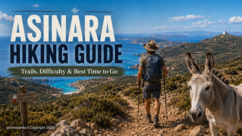
All the official Asinara hiking trails, how difficult they really are, how to reach the trailheads, when to walk, guided excursions, food, water, wildlife and the mistakes I would avoid
My name is Gavino. I am from Nuoro, I spend a lot of my free time hiking and mountain biking, and Asinara is one of those places where I willingly leave my little 4×4 on the mainland.
That already tells you something.
On most of Sardinia I am used to solving logistics with a vehicle. On Asinara you solve them with planning.
The island is narrow and long, crossed by a roughly 25-kilometre concrete road between Fornelli in the south and Cala d’Oliva farther north. The Park’s hiking network branches from this backbone along old mule tracks, prison roads, pastoral routes and military tracks. The National Park itself recommends dividing a thorough visit into at least three days: one for Fornelli, one for Cala Reale and one for Cala d’Oliva. (parcoasinara.org)
I agree.
You can visit Asinara in one day. We already explain how in Stintino & Asinara: The Complete Local Guide to North-West Sardinia. But if your objective is hiking rather than simply seeing the island, one day forces compromises.
And there is another thing I want to establish immediately.
Asinara is not primarily a summer hiking destination.
The Park recommends spring and autumn and explicitly warns against walking and cycling during the summer months because of intense solar exposure, high temperatures, limited water and very little continuous shade. In July and August it recommends considering other ways of visiting and restricting walking to short sections, preferably near the coast. (parcoasinara.org)
That is not excessive caution.
It is the most useful advice in this entire guide.
Asinara’s Official Hiking Trails at a Glance
| Trail | Area | Distance | Official time | Elevation | My difficulty | Best for |
|---|---|---|---|---|---|---|
| Granite Trail | Fornelli | 11.2 km | 3h 30 | 75 m | Moderate | Best all-round southern hike |
| Castellaccio Trail | Fornelli | 8.3 km | 2h 40 | 212 m | Moderate | Views, wildlife, medieval ruins |
| Water Trail | Fornelli | 6.9 km | 2 h | 42 m | Easy | Families, history, relaxed walking |
| Mouflon Trail | Cala Reale/Tumbarino | 6.1 km | 2 h | 50 m | Easy–moderate | Wildlife, birdwatching |
| Memory Trail | Cala Reale | 5.5 km | ~1h 30 | Flat | Easy | Archaeology and human history |
| White Donkey Trail | Cala Reale | 7.8 km | 3 h | Flat | Easy–moderate | Donkeys, Trabuccato, prison landscape |
| Nature Trail | Cala Reale | 2 km | 1 h | Flat | Easy/accessibility-oriented | Families, short walks |
| Holm Oak Trail | Cala d’Oliva | 13.7 km | ~3h 20 | 408 m | Moderate–demanding | Best proper hike |
| Lighthouse Trail | Cala d’Oliva | 17.9 km | 5h 30 | 120 m | Moderate by terrain, demanding by length | Isolation, Punta Scorno |
| Cala Sabina Trail | Cala d’Oliva | 1.3 km | 50 min | 10 m | Easy | Short coastal walk |
| Trabuccato Trail | Cala Reale area | 6.5 km | 1h 45 | 62 m | Easy–moderate; harder coastal variant | Coast + prison history |
These distances and official walking times come directly from the National Park trail network. My difficulty ratings are deliberately more practical: 18 kilometres under Asinara sun is not “easy” simply because the elevation graph looks flat. (parcoasinara.org)
Which Asinara Trail Should You Choose?
If it is your first proper hike, choose the Granite Trail. If history matters more than physical effort, choose the Memory Trail. If wildlife is the priority, choose the Mouflon Trail. If you want the best actual hike rather than a long walk, I choose the Holm Oak Trail to Punta della Scomunica. If you want isolation and have enough daylight, water and fitness, choose the Lighthouse Trail. With children, I start with the Water Trail, Nature Trail or Memory Trail.
Now the routes properly.
1. Granite Trail — My Best First Asinara Hike
Fornelli | 11.2 km | 3h 30 | 75 m | mostly cyclable | Moderate
The Granite Trail begins directly from Fornelli Pier, which makes it unusually convenient if your boat arrangement brings you to the southern end of the island.
After leaving the pier you pass a back-dune pond, move inland towards the old prison road and then descend towards Punta Barbarossa. Winter ponds attract ducks and herons; farther on, the route reaches Punta Li Giorri and begins showing the granite that gives the trail its name. Old quarries still contain traces of working activity and handmade shelters, while the final part approaches Cala Sant’Andrea and its integral-protection landscape. (parcoasinara.org)
This is why I choose it first.
You get coast, geology, wetlands, human history and old quarrying activity without needing serious elevation.
The final rocky sections require more attention than the first kilometres suggest, but a reasonably fit walker should have no problem in good weather.
Gavino’s detour: stop at the quarry remains and look before walking on. Once you begin identifying how stone was extracted and worked, what first looked like random granite starts telling you something about the people who used this island.
Gavino wouldn’t do this: treat the neighbouring Cala Sant’Andrea integral reserve as an invitation to find a shortcut to the water. Zone A is integral reserve; access is prohibited except for strictly authorised Park activities. (parcoasinara.org)
2. Castellaccio Trail — Best Short Climb and Southern Viewpoint
Fornelli | 8.3 km | 2h 40 | 212 m | partially cyclable | Moderate
The Castellaccio route initially follows the road past the former Fornelli prison and old prison-administration buildings: guard posts, accommodation, laundry structures and watering points. After roughly two kilometres you leave the easier road and take an old mule track towards the ruined medieval Castellaccio. The final section becomes steeper, and the Park notes that wild goats and groups of mouflon are frequently seen here. (parcoasinara.org)
At the top, the reward is one of my favourite views in southern Asinara: Stintino, Isola Piana, the Fornelli Strait and the Nurra peninsula.
This is also a good example of why I like hiking archaeology.
The castle is not an isolated attraction with a ticket office.
You understand why somebody wanted this high point precisely because you have walked up from the plain and seen what can be controlled visually from the summit.
On the return you can also connect the landscape with the remains of the First World War prison camp in the Fornelli plain, including the ruined chapel and small cemetery area. (parcoasinara.org)
Best for: people who want more climbing without committing to a long northern trail.
3. Water Trail — The One I Would Do with Children
Fornelli | 6.9 km | 2 h | 42 m | loop | fully cyclable | Easy
The name sounds less exciting than “Lighthouse Trail”.
Ignore that.
The Water Trail is clever.
Starting from the Fornelli Visitor Centre area, it uses water as the theme connecting sea, freshwater, coastal ponds, wells, drinking troughs, springs, small dams, reservoirs and the infrastructure once needed to make human settlement possible on an island where water has always mattered. (parcoasinara.org)
You also pass the old Punta Salippi guard position, the outside coast, the earth dam below the Castellaccio massif and finally water-system infrastructure and the former prison environment.
That gives children something to discover repeatedly.
A flat trail becomes boring when nothing changes.
This one changes.
It is also entirely cyclable, making it relevant to our future Asinara by Bike guide.
Gavino’s detour: Punta Salippi. In suitable conditions it makes a natural place to stop, but do not let a swim turn a two-hour itinerary into a missed return boat.
4. Mouflon Trail — Best for Wildlife
Tumbarino Wildlife Observatory | 6.1 km | 2 h | 50 m | loop | not cyclable | Easy–moderate
This is not the trail I walk quickly.
The whole point is stopping.
The Park identifies mouflon, wild boar, Sardinian partridge, crows, gull colonies and European shags among the wildlife associated with the route and describes it as particularly valuable for birdwatching during spring and autumn migration. The trail is connected with the Wildlife Observatory at the former Tumbarino prison branch, where bird-ringing and population-monitoring activities are carried out. (parcoasinara.org)
Spring and autumn are therefore not merely more comfortable.
They are biologically more interesting.
Bring binoculars.
A 10× pair of binoculars causes considerably less disturbance than walking towards an animal with a telephone held in front of your face.
Leave it better: never feed the wildlife. The Park expressly prohibits disturbing or feeding wild animals. (parcoasinara.org)
5. Memory Trail — The Best History Walk
Cala Reale | 5.5 km | ~1h 30 | flat | loop | fully cyclable | Easy
If you have already read our Stintino & Asinara: The Complete Local Guide to North-West Sardinia, you know why the island’s history is much more complicated than “former prison island”.
The Memory Trail puts that history under your feet.
From Cala Reale you encounter the Austro-Hungarian chapel, Campo Faro, a small penitentiary settlement, barracks and the Italian cemetery connected to events of 1916. Then the route reaches Campu Perdu, formerly an agricultural prison branch, before going much farther backwards in time with the Domus de Janas. Nearby is the Austro-Hungarian ossuary containing the remains of more than 5,000 First World War prisoners. The Marine Observatory and marine-animal recovery centre also lie along the route. (parcoasinara.org)
Five and a half kilometres.
Prehistory to twentieth-century imprisonment.
That is a very efficient walk.
Gavino’s Archaeology Rule
If you notice something that looks archaeological, do not pick it up, clean it or move it for a better photograph. The Park specifically prohibits removal or damage to archaeological remains, minerals, plants and shells. More generally, Italian cultural-heritage law requires an accidental archaeological discovery to be reported within 24 hours to the competent Soprintendenza, Mayor or public-security authority and normally left where it was found. (parcoasinara.org)
Finding something does not make it yours.
It makes you responsible for what happens next.
6. White Donkey Trail — Wildlife Plus Trabuccato
Cala Reale | 7.8 km | 3 h | essentially flat | not cyclable | Easy–moderate
Yes, you are likely to see the famous white donkeys.
But the trail would still be worth walking without them.
It begins from the Cala Reale Visitor Centre area and crosses the landscape of the former Maritime Health Station before reaching the Trabuccato prison branch. Along the way are former guards’ houses, agricultural structures, the old wine cellar and the coastal tower of Trabuccato. (parcoasinara.org)
The mistake here is turning the donkeys into entertainment.
They are not a petting zoo.
Observe them.
Photograph them without blocking their movement.
Do not feed them.
The photograph where the donkey is standing naturally ten metres away is better than the photograph of your hand forcing an animal interaction.
Best for: first-time visitors who want the recognisable Asinara wildlife without sacrificing history.
7. Nature Trail — Short, Accessible and Better Designed Than Most “Easy Trails”
Cala Reale | 2 km | 1 h | flat | not cyclable | Easy
The Nature Trail deserves mention precisely because accessibility is normally an afterthought in outdoor tourism.
Here it was designed into the route.
The trail includes Braille information and tactile interpretation stations for visually impaired visitors. The first 350 metres can also be used by wheelchair users, ending at an adapted picnic area, while a rope handrail guides visitors for about 830 metres of the circular route. Short branches lead towards the sea and the Mediterranean Garden thematic trail. (parcoasinara.org)
I would combine it with the Memory Trail rather than travelling to Asinara exclusively for two kilometres.
But for families, multi-generational groups or visitors with different mobility levels, it is one of the smartest parts of the Park network.
8. Holm Oak Trail — My Favourite Proper Hike on Asinara
Cala d’Oliva | 13.7 km | ~3h 20 official time | 408 m | loop | not cyclable | Moderate–demanding
This is the one I would choose for myself.
From the Memory Observatory in Cala d’Oliva, the route climbs towards Case Bianche through old terraces, springs, drinking troughs and valleys once used as gardens. After Case Bianche the landscape changes noticeably: chestnuts and holm oaks appear, together with water channels and the Elighe Mannu botanical area. A deviation climbs towards Punta della Scomunica, the highest point on Asinara, before the trail enters the island’s higher landscape around Punta Maestra Serre, where low cloud and mist can sometimes replace the stereotypical dry-island scenery. Wild goats inhabit this upper sector. The descent passes Cuile Zonca and eventually returns towards the sea and Cala d’Oliva. (parcoasinara.org)
This is Asinara showing another personality.
The coast disappears for a while.
Vegetation changes.
Elevation becomes relevant.
Weather becomes more noticeable.
For somebody from Nuoro, parts of it feel strangely more familiar than the beaches below.
A Note About the Official Walking Time
The Park gives around 3 hours 20 minutes.
I would allow considerably more if you actually want to observe the landscape, visit the viewpoints, stop for food and take the Scomunica deviation.
I do not judge hikes by whether I can beat a signpost.
Gavino wouldn’t do this: start after lunch because the distance “is only fourteen kilometres”. Daylight access rules matter, and so does having margin when something takes longer than expected.
9. Lighthouse Trail — The Long One
Cala d’Oliva | 17.9 km | 5h 30 | 120 m | not cyclable | Moderate terrain, demanding length
The Lighthouse Trail is technically easier than its distance suggests.
That does not make it easy.
From Cala d’Oliva the dirt road moves towards Punta Sabina, with a short deviation towards Cala dei Ponzesi, then continues high above the western cliffs among great rounded euphorbia bushes. Farther north the trail approaches Cala d’Arena, one of the island’s most beautiful bays — and one that must remain exactly what it is. Cala d’Arena, its dunes and juniper system form an integral reserve: access and swimming are prohibited. (parcoasinara.org)
Continue and you reach the lonely Punta dello Scorno Lighthouse. A deviation leads towards the remains of the former Semaforo meteorological station, now also used by birds of prey. The Park describes the route accurately: easy in technical terms, very long in practice. (parcoasinara.org)
This is where flat-route statistics mislead tourists.
Seventeen-point-nine kilometres.
Little shade.
Few water options.
Sun.
Wind.
Return logistics.
I classify it as demanding for an ordinary holiday walker even though I would not classify the terrain as technically difficult.
When I Would Walk It
March–May.
October.
Possibly a cool late-September day.
I would not choose it in July or August.
The National Park does not recommend summer hiking either. (parcoasinara.org)
10. Cala Sabina Trail — Short Coastal Option from Cala d’Oliva
Cala d’Oliva | 1.3 km | 50 min | 10 m | Easy
The trail begins near Cala d’Oliva’s small cemetery and follows an old coastal mule track towards Cala dei Ponzesi, historically associated with fishermen from Ponza. (parcoasinara.org)
It is short enough to combine with Cala d’Oliva’s historical sites.
I also like it as a solution for those shoulder days when the weather makes a long trail unattractive but sitting still would be a waste.
And it illustrates something important about Asinara:
not every day needs to be seventeen kilometres.
11. Trabuccato Trail — Two Routes in One
Cala Murighessa / Cala Reale | 6.5 km | 1h 45 | 62 m | out-and-back/connecting route | Easy–moderate
The trail begins from Cala Murighessa, also known as the prisoners’ beach, heading towards Trabuccato. At Cala le Soriane it splits: the coastal option is identified by the Park as the expert route, while the higher line is easier and suitable for a broader range of walkers. From Cala Barche Napoletane the trail continues towards Cala Trabuccato and eventually reconnects with the concrete road near the former prison branch, continuing towards Cala Reale. (parcoasinara.org)
I like routes with choices.
They allow you to respond to conditions.
If the rock is wet, wind is unpleasant or somebody in the group is tired, there is no honour in taking the more technical coastal variant because the map labels it “expert”.
Choose the route that suits the day.
Best Time to Hike Asinara
The short answer is spring and autumn. That is both my recommendation and the Park’s. (parcoasinara.org)
March: excellent for walking when weather cooperates; green landscape, cooler conditions. April: one of my favourite months; excellent temperatures and active wildlife. May: probably the best overall combination of daylight, vegetation and warmth. June: good early in the month, but heat begins becoming a planning factor. July–August: not my hiking season here; the Park itself advises avoiding walking excursions and choosing other ways to visit. September: potentially excellent later in the month; early September can still feel completely like summer. October: excellent, particularly for longer trails and bird migration. November: underrated, but daylight and ferry logistics need more care. Winter: possible in suitable conditions, quiet and atmospheric, but transport/services are more limited and weather controls the day.
If somebody offered me one week to walk Asinara?
Late April or October.
How Many Days Do You Need for Hiking Asinara?
The Park recommends a minimum of three days for a sufficiently complete observation of the island, dividing the visit between Fornelli, Cala Reale and Cala d’Oliva. (parcoasinara.org)
For hikers, I would use exactly that structure.
Day 1 — Fornelli: Granite Trail or Castellaccio + Water Trail depending fitness. Day 2 — Cala Reale/Tumbarino: Memory + Nature for culture, or Mouflon for wildlife; White Donkey if you want a longer excursion. Day 3 — Cala d’Oliva: Holm Oak Trail for the best overall hike, or Lighthouse Trail for distance and isolation.
That is a real Asinara hiking trip.
One day is a sample.
How to Get to the Asinara Trailheads
This is where people make planning mistakes.
The public territorial-continuity ferry operated by Delcomar connects Porto Torres with Cala Reale, departing from the Dogana-Segni quay. Timetables change seasonally, so check the current schedule rather than building an itinerary around an old screenshot. (parcoasinara.org)
The Park also lists authorised maritime passenger operators connecting Stintino and Asinara, but exact departure times, landings and excursion format depend on the operator. (parcoasinara.org)
This creates a simple rule:
Choose the trail before choosing the boat.
Landing at Cala Reale is perfect for the Memory, Nature and White Donkey trails. It is not the same thing as arriving at Fornelli for the Granite Trail or already being at Cala d’Oliva for the Holm Oak and Lighthouse routes.
Do not assume you can casually cross 25 kilometres of island road between trailheads.
Arrange any transfer you need before arrival.
For general ferry logistics, Stintino accommodation and how Asinara fits into a wider North-West Sardinia trip, use our Stintino & Asinara: The Complete Local Guide to North-West Sardinia rather than duplicating all of that information here.
Should You Hire a Guide?
For ordinary marked Park trails, experienced walkers do not necessarily need professional accompaniment simply to place one foot after another. But the Park itself recommends visiting with authorised operators, and a guide becomes considerably more valuable when you want history, wildlife interpretation, transport between trailheads or a route you do not know. (parcoasinara.org)
Remember the distinction: I am Gavino, The Outdoor Guide of this portal. I write about routes I know and research. I am not selling professional guiding services on Asinara.
If you want a guided walk, use people authorised to do the job.
Current Park-Listed Guided Walking Services
The Park’s current authorised-operator directory lists the following among its guided walking visit services: AeRA di Stefania Pisanu — +39 347 651 2084, aera.escursioni@gmail.com; Alberto Deiana — +39 393 644 8499, deianalbert@gmail.com; Asinara 4×4 — +39 347 215 1286, info@asinara4x4.com; AsinarAvventura — +39 340 861 0696, info@asinaravventura.com; NurAnima di Anna Maria Sanna — 349 534 6801, amsanna.ams@gmail.com; Wild Asinara Park — +39 347 889 3272, info@wildasinarapark.com. (parcoasinara.org)
I would tell the operator exactly what you want rather than asking for “an Asinara excursion”.
Say:
“We want to walk, not spend most of the day in a vehicle.”
There is a difference.
Food and Water on Asinara
Carry enough water.
Read that sentence again before thinking about restaurants.
The National Park repeatedly identifies limited water availability and lack of shade as important hiking constraints. (parcoasinara.org)
The current Park directory lists three principal refreshment points: a kiosk at Fornelli Pier (+39 347 062 7631), the bar service at Cala Reale (+39 340 984 8914), and Ittiturismo La Locanda del Parco at Cala d’Oliva (+39 377 379 7209). La Locanda del Parco is also currently listed by the Park as an accommodation option on the island. (parcoasinara.org)
I do not plan a 14- or 18-kilometre hike assuming a bar will solve my hydration.
Opening days change.
Stock runs out.
Plans change.
Water goes in the backpack.
The bar is a bonus.
What I Carry on Asinara
My basic Asinara kit is simple: proper walking shoes rather than smooth beach footwear; more water than I think I will drink; food; hat; high-protection sunscreen; sunglasses; light windproof layer in shoulder season; small first-aid kit; charged phone and power bank; Park map or offline route; small rubbish bag.
There are very few places on Asinara where I regret carrying an extra litre of water.
There are many where I would regret not carrying it.
Can You Camp or Bivouac on Asinara?
Not wherever you want.
The Park regulation states that camping and bivouacking are permitted only with prior Park authorisation and in areas specifically designated for that purpose. (parcoasinara.org)
So no:
“We will just put the tent somewhere near the lighthouse.”
That is not adventurous.
That is ignoring the regulations of a National Park.
If you want to stay on the island, use authorised accommodation or obtain whatever specific authorisation applies to the activity you are planning.
Can You Bring a Dog Hiking on Asinara in 2026?
This changed recently, so old articles may be wrong.
Following a 24 June 2026 Park decision, dogs, cats and other pets can now access the designated Zone D areas, subject to the conditions in Article 12 of the Park regulation. However, pets remain prohibited in Zones A, B and C, and the regulation does not allow them to use the connecting roads between one urban area and another. Dogs in permitted areas must have the required health documentation, remain on a leash and owners must carry waste-collection equipment. (parcoasinara.org)
For a hiker, the practical conclusion is simple:
do not plan an Asinara hiking holiday with your dog.
Most of the trail network is not a Zone D urban walk.
Other Park Rules Hikers Should Actually Know
Pedestrian access in Zones B, C and D is permitted only on marked trails and designated routes, and only during daylight hours. Zone A is closed to ordinary access. Organised walking groups larger than 20 people must notify the Park with details of the excursion. (parcoasinara.org)
Recreational drone use is not allowed; authorisation is reserved for permitted scientific or public-interest purposes. Do not disturb or feed wildlife, remove plants, shells, minerals or archaeological material, or damage historical structures. (parcoasinara.org)
Most of these rules require very little sacrifice.Leave things where they are and walk where you are supposed to walk.
Do not feed the donkey.
Reasonable.
Is Asinara Safe to Hike Alone?
The main problem for an ordinary competent hiker is generally not technical mountain terrain.
It is exposure, heat, distance and logistics.
An 18-kilometre trail with only 120 metres of elevation can still become a bad day if you start late with inadequate water.
If walking alone, I become more conservative. I choose a route I understand, make sure somebody knows my plan, check the return transport first, carry more water and avoid pushing into a harder variant merely because I feel good at the halfway point.
If conditions are wrong, I change the trail.That is not failure.That is how I intend to be around long enough to walk it again.
In a serious emergency, use 112.
The Best Asinara Trails for Families
My first choice is the Water Trail. Then the Memory Trail and Nature Trail.
The Nature Trail is especially valuable for mixed groups because part of it was explicitly designed for wheelchair accessibility and visually impaired visitors. (parcoasinara.org)
With older children who already walk regularly, the Granite Trail becomes interesting.
I would not choose the Lighthouse Trail as a family’s first experiment with hiking because everybody survived a six-kilometre promenade last year.
Seventeen kilometres is still seventeen kilometres.
Best Asinara Trail for Wildlife
Mouflon Trail.No hesitation.Spring or autumn.Binoculars.Slow pace.
The White Donkey Trail is better specifically for the island’s famous donkeys, but the Mouflon Trail is more interesting as a wider wildlife outing. (parcoasinara.org)
Best Asinara Trail for History
Memory Trail for human history across several periods.
Castellaccio for the relationship between history and strategic landscape.
White Donkey/Trabuccato for the prison and agricultural world.
If your interest is specifically the penal colony and modern history, combine walking with the Memory Observatory at Cala d’Oliva rather than trying to understand everything from outdoor ruins alone.
Best Asinara Trail for Experienced Hikers
For an ordinary experienced recreational hiker, I choose the Holm Oak Trail rather than the Lighthouse.
Why?More elevation.More landscape change.More variety.
The Lighthouse Trail wins on isolation and distance.The Holm Oak wins as hiking.
Best Trail If You Have Only Half a Day
From Cala Reale: Memory Trail.
From Fornelli: Water Trail, or Castellaccio if you move comfortably and have enough transport margin.
From Cala d’Oliva: Cala Sabina for an easy outing; a shortened local exploration rather than starting the Lighthouse Trail with a deadline.
The arrival point decides the answer.
Can You Combine Hiking and Cycling?
Yes, but not every trail.
The Park explicitly marks the Granite Trail as largely cyclable, the Castellaccio as partially cyclable, and both the Water and Memory trails as entirely cyclable. The Mouflon, White Donkey, Nature, Holm Oak, Lighthouse, Cala Sabina and Trabuccato trails are marked as non-cyclable in the current official network. (parcoasinara.org)
At Fornelli the current Park directory lists Herculis Rent Bike, +39 345 518 8764 / +39 347 198 7798, herculisrentebike@gmail.com. (parcoasinara.org)
We will deal properly with that in Asinara by Bike.
I will have opinions.
A Three-Day Hiking Itinerary I Would Actually Do
Day 1 — Fornelli: arrive early, Granite Trail, proper stop around the quarry landscape, return with enough margin for the boat or overnight logistics. Day 2 — Cala Reale: Memory Trail first, then either Nature Trail or a guided wildlife outing around Tumbarino depending transport. Spend time at the historical structures rather than using the day as a step-count competition. Day 3 — Cala d’Oliva: Holm Oak Trail with Punta della Scomunica. Return, eat properly and walk through Cala d’Oliva when your legs have stopped complaining.
For somebody fitter who specifically wants distance, substitute the Lighthouse Trail on Day 3.
For somebody primarily interested in archaeology and history, keep Memory, add Castellaccio and dedicate more time to Cala d’Oliva’s prison landscape.
For everything else you can do on the island — 4×4 excursions, biking, sailing, wildlife experiences and diving — our Northern Sardinia Beyond the Beaches: 25 Things Actually Worth Doing provides the wider activity hub.
Asinara Hiking FAQ
Is Asinara good for hiking?
Very. The island has an official thematic trail network covering Fornelli, Cala Reale/Tumbarino and Cala d’Oliva, with routes ranging from 2 km to 17.9 km. (parcoasinara.org)
What is the best hike on Asinara?
For a first visit, the Granite Trail. For the best hiking experience, my choice is the Holm Oak Trail. For history, the Memory Trail; for wildlife, the Mouflon Trail.
What is the longest Asinara trail?
The Lighthouse Trail, 17.9 km with an official walking time of about 5 hours 30 minutes. (parcoasinara.org)
What is the hardest Asinara hike?
There is no highly technical mountain route in the official network, but the Holm Oak Trail combines 13.7 km with 408 metres of elevation, while the Lighthouse Trail is demanding mainly because of its 17.9 km length, exposure and limited shade.
What is the easiest trail on Asinara?
The 2 km Nature Trail is the easiest and includes accessibility features. The 5.5 km Memory Trail is the best easy full hiking experience.
Can I hike Asinara without a guide?
Standard marked trails can be explored independently within Park rules, although the Park recommends authorised operators and a guide can be very useful for transport, wildlife and historical interpretation. (parcoasinara.org)
When is the best time to hike Asinara?
Spring and autumn. April, May and October are my favourite months.
Can you hike Asinara in July or August?
You physically can walk short routes, but the National Park strongly discourages hiking and cycling during the summer months because of heat, intense sun, lack of shade and limited water. (parcoasinara.org)
Can you hike to Cala d’Arena?
The Lighthouse Trail passes through the wider landscape, but Cala d’Arena itself is an integral reserve and access and bathing are prohibited. (parcoasinara.org)
Can I hike with my dog?
Not across the normal trail network. In 2026 pets were permitted under conditions in designated Zone D areas, while Zones A, B and C remain prohibited to them. (parcoasinara.org)
Can you camp on Asinara?
Only with prior Park authorisation and in areas specifically designated for camping or bivouacking.
Is there food on Asinara?
Yes. The Park currently lists a kiosk at Fornelli, a bar service at Cala Reale and La Locanda del Parco at Cala d’Oliva. Do not rely on them as your sole water strategy for a long hike. (parcoasinara.org)
How do you reach Asinara for hiking?
The public Delcomar ferry connects Porto Torres with Cala Reale, while authorised passenger services also operate from Stintino. Choose your landing according to the trail you want to walk and verify seasonal schedules beforehand. (parcoasinara.org)
How many days do you need?
The National Park itself recommends at least three days for a sufficiently complete visit, dedicating one day each to the Fornelli, Cala Reale and Cala d’Oliva areas. (parcoasinara.org)
Final Thoughts: Asinara Is Better When You Stop Trying to Cover It
The first time people look at Asinara on a map, the island seems manageable. Long. Narrow. One road. Simple.
Then you walk.The scale changes.A ruined guardhouse becomes twenty minutes.A group of mouflon becomes another twenty because you stop moving.
You reach an old quarry and start looking at tool marks.You find a wall and wonder whether it belongs to farming, prison infrastructure or something older.
The sea appears again. Then disappears. That is what I like about Asinara on foot. A 4×4 shows you more places. A bicycle covers more kilometres.
A boat shows you the coast better. Walking shows you the distance between things. And that distance is part of the island’s history.
Prisoners walked it.Guards walked it.Shepherds walked it. Quarry workers walked it. People reached water because water was somewhere specific, not because somebody carried a bottle from the supermarket.
You begin noticing those things only when you slow down. So choose one trail. Carry enough water. Start early. Leave the animals alone. Do not remove anything.
If you find rubbish, take a little more out than you carried in. And when a sign tells you a protected area stops there, believe it.
You have not travelled all the way to a National Park to prove that rules do not apply to you.
Walk it properly. It will still feel wild.