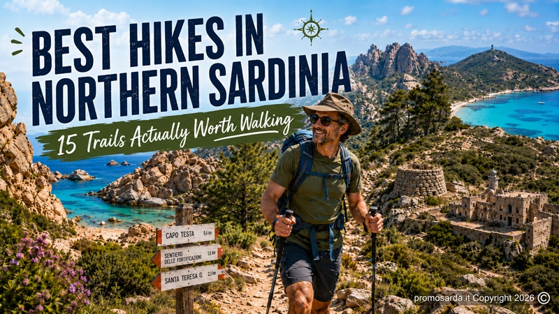
Coastal paths, granite mountains, Nuragic sites, mining landscapes, wildlife and military history from Alghero and Stintino to Asinara, Monte Limbara and Caprera
My name is Gavino. I am from Nuoro, although I have spent enough time wandering around Northern Sardinia to know which tracks improve after rain, which ones become unpleasant in August and which “short walk” descriptions were clearly written by somebody who never carried three litres of water.
I hike. I trek, usually at moderate or moderately demanding level. I ride mountain bikes much more often than I ride downhill. I am a decent horseman. I like archaeology, old structures, strange stones, forgotten roads, mines, military remains and the places where somebody once built something for a reason that is no longer obvious.
I also own a small 4×4. It gets me to useful places. It is not an excuse to drive everywhere.
That distinction matters.
I am The Outdoor Guide of this website, not a professional hiking guide selling excursions. I do not take paying clients into the mountains. Where professional accompaniment makes sense or is required, I use or recommend qualified local guides.
And I have one habit that irritates some of my friends.
I pick up rubbish.
Not every cigarette butt across Sardinia. I would never get home. But if I arrive at a viewpoint, nuraghe, old military position or trail junction and somebody has left a bottle or food packaging there, I normally carry it out.
The first person who showed me these places left them beautiful enough for me to enjoy.
I can return the favour.
These are 15 Northern Sardinia hikes I think are actually worth your time.
The 15 Best Hikes in Northern Sardinia at a Glance
| Trail | Area | Distance / time | Difficulty | Why I go |
|---|---|---|---|---|
| Punta Giglio | Alghero | Flexible, usually 2–3 h | Easy–moderate | Cliffs + WWII history |
| Monte Timidone & Cala Barca | Porto Conte | ~8 km / about 4 h | Moderate | Wildlife + 360° views |
| Argentiera Coastal Trail | Nurra | ~4 km / 3–3.5 h | Moderate–high | Mining archaeology |
| Villanova → Nuraghe Appiu | Villanova Monteleone | 9.4 km one way / 2.5 h | Easy–moderate | Archaeology + cork woods |
| Lu Biggiu Marinu → Torre del Falcone | Stintino | 1.3 km / ~1 h return | Moderate | Short climb, huge view |
| Sentiero del Granito | Asinara | 11.2 km / 3 h 30 | Moderate | Granite, prison history, wildlife |
| Sentiero della Memoria | Asinara | 5.5 km / ~1.5 h | Easy | Archaeology + WWI history |
| Sentiero del Leccio | Asinara | 13.7 km / ~3 h 20 | Moderate | Highest Asinara landscape |
| Li Cossi → Li Tinnari | Costa Paradiso | ~6–7 km one way | Moderate | Wild red-rock coast |
| Vallicciola → Punta Bandera F-402 | Monte Limbara | 4.6 km one way / 1 h 45 | Moderate | Granite + Sa Berritta |
| Capo Testa Loop | Santa Teresa | Flexible / 2.5–4 h | Easy–moderate | Granite + Roman quarries |
| Punta Falcone Military Landscape | Santa Teresa | Flexible / 2–3 h | Moderate | WWII ruins + wilderness |
| Monte Tejalone | Caprera | Short / ~1–2 h | Short but steep | Highest viewpoint on Caprera |
| Cala Napoletana | Caprera | Half-day | Moderate | Wild north coast |
| Punta Crucitta–Candeo | Caprera | Half-day loop | Moderate | Best mix of nature + military history |
Important: trail conditions change. Distances shown as exact are taken from current official trail authorities where available; my flexible times are how I plan the outing, not contractual promises from the mountain.
Before We Start: Northern Sardinia Is Hotter on Foot Than It Looks from a Car
A surprisingly large number of hiking mistakes begin in an air-conditioned vehicle.
You get out. The sea breeze feels pleasant. The trail is only ten kilometres. You have one half-litre bottle.
Two hours later, Christianity is being tested.
For serious walking I prefer March to June and late September to November. Spring is magnificent. Autumn can be even better after the first rains. July and August require early starts and route selection based on shade, exposure and water.
Asinara National Park goes considerably further: because of intense sun, high temperatures, limited water and lack of shade, it strongly advises against hiking and cycling during the summer months.
That is not bureaucratic pessimism.
It is good advice.
Another tool I use is the official Sardegna Sentieri / RES system. It contains the regional trail catalogue, validation status, maps and warnings, and its interactive map can also indicate areas where hunting and hiking may interfere.
Check the trail shortly before going.
A GPX downloaded three years ago does not know that vegetation grew, a storm passed or maintenance began.
1. Punta Giglio — Alghero’s Best Combination of Hiking and History
Area: Porto Conte Regional Park | Allow: 2–3 hours for a sensible exploration | Difficulty: easy to moderate | Best: spring, autumn, early summer mornings.
Punta Giglio is where I take people who insist that hiking must involve a summit.
It doesn’t.
The peninsula has a network of routes rather than one single compulsory track. You move through Mediterranean scrub and pine woodland towards high limestone cliffs, with Porto Conte opening on one side and Alghero on the other. Peregrine falcons and Scopoli’s shearwaters are among the birds associated with this protected environment.
Then history appears.
At the top are the remains of the SR 413 coastal battery, built by the Italian Royal Navy between the world wars. The military landscape has been incorporated into a historical-environmental open-air museum area.
This is exactly my kind of walk.
Nature does not stop because a wall appears.
Human history does not stop because a peregrine flies past it.
They occupy the same landscape.
Gavino’s detour: spend time around the military structures rather than merely reaching the viewpoint and immediately returning. If you have another half-day in the area, add the Nuragic complex of Palmavera rather than another beach.
Useful locally: Coop. Exploralghero operates from the Porto Conte park area and provides visitor/excursion services; the Punta Giglio forest complex itself has an information point, toilets and bike rental during its service season, generally April–October. If you want independent cycling on another day, Raggi di Sardegna Rent a Bike E-Bike & Tour is at Via Majorca 119 in Alghero.
Leave it better: military buildings are not canvases. Do not scratch names into walls that survived eighty years without needing yours.
2. Monte Timidone & Cala Barca — The Porto Conte Walk I Prefer for Wildlife
Area: Le Prigionette, Porto Conte | Distance: around 8 km on the classic Timidone–Cala Barca outing | Allow: about 4 hours | Difficulty: moderate.
Monte Timidone is more physical than Punta Giglio but still accessible to ordinary hikers with reasonable fitness.
The classic route rises through woodland and Mediterranean vegetation towards roughly 360–400 metres, opening into a 360-degree viewpoint over Porto Conte. One documented park itinerary combining Timidone and Cala Barca covers about 8 km, with roughly 351 metres of height difference; Cala Barca adds a dramatic cliff viewpoint over Isola Piana.
Le Prigionette also changes the experience because of wildlife. The reserve is associated with fallow deer, Giara horses, donkeys, goats, mouflon and griffon vultures.
I stop for griffons.
Always.
If a bird with almost three metres of wingspan decides to use the same sky as me, my timetable can wait.
Gavino wouldn’t do this: walk directly beneath wildlife trying to get a better phone video. Binoculars are cheaper than disturbing an animal.
The park allows independent visits in the reserve and also guided walking, cycling and electric-vehicle experiences. Coop. Exploralghero is useful here again because it is directly connected to the protected-area visitor services rather than being an operator driving in from somewhere else.
3. Argentiera Coastal Trail — Northern Sardinia’s Best Industrial-Archaeology Walk
Area: Argentiera, Sassari | Current guided 2026 route example: about 4 km / 3–3.5 hours | Difficulty: moderate to moderately high | Best: spring, autumn, sunrise or late afternoon.
Argentiera is not beautiful in the easy Sardinian way.
It is scarred.
That is why I like it.
The abandoned mining landscape sits between cliffs and sea, with old industrial structures, waste heaps, narrow valleys and the remains of a settlement that grew around silver-bearing lead and zinc extraction. The mine closed in the twentieth century and the area is now considered one of Northern Sardinia’s significant industrial-archaeology landscapes.
In 2026, official guided coastal outings have used a roughly 4 km loop taking around 3½ hours, beginning near the Laveria, crossing Mediterranean scrub towards Punta Argentiera and incorporating the Lago delle Vergini, wildlife observation and an old military fort with views towards Punta Cristallo and Porto Conte. The terrain is classified medium-high difficulty and is unsuitable for pushchairs or people with reduced mobility.
The MAR–Miniera Argentiera project has also been running guided sunrise and sunset outings with qualified environmental hiking guides during summer 2026.
I walked Argentiera again more recently because this is a landscape that is actively changing through regeneration projects.
That matters.
My memories of abandoned mining buildings are not automatically a current access map.
Gavino wouldn’t do this: climb through a broken opening because an industrial ruin looks abandoned. “Nobody uses it” and “I am allowed inside” are different sentences.
Gavino’s detour: allow time for the mining village itself. Walking the cliffs without understanding the mine is only half the experience.
Leave it better: this is one of the places where I almost always end up carrying somebody else’s plastic bottle back to the car. Please make that job unnecessary.
4. Villanova Monteleone to Nuraghe Appiu — The Trail I Recommend to Archaeology People
Official trail: E-303 | Distance: 9.4 km one way | Time: about 2 h 30 one way | Elevation gain: 233 m | Current status: in review/validation — check before walking.
This is almost perfectly designed for me.
A long dirt route leaves Villanova Monteleone, passes dry-stone walls, pasture and cork woodland, gives broad views towards Capo Caccia and the Nurra, and eventually reaches Nuraghe Appiu.
The official trail catalogue notes both eagles and griffons in the area and describes Appiu as an unusually significant monument in Sardinia’s protohistoric landscape.
The important logistical detail is one way.
Do not read “9.4 km / 2½ hours” and then discover at the nuraghe that your car remains 9.4 kilometres away.
Arrange two vehicles, a pickup or plan the full return.
This route is also registered for hiking, MTB and horse use, which makes it particularly interesting for a future Gavino cycling article.
If You Find Something Archaeological
Do not pick it up because you want to “show it to the museum”.
Italian law requires a fortuitous archaeological discovery to be reported within 24 hours to the competent Soprintendenza, the Mayor or public-security authorities; normally it should be left in the condition and location where it was found.
Take useful photographs without disturbing it. Record the position. Report it.
I love discovering things.
That does not mean they become mine.
5. Lu Biggiu Marinu to Torre del Falcone — The Short Hike That Earns Its View
Area: Capo Falcone, Stintino | Distance: 1.3 km total | Time: about one hour return | Elevation: roughly 140 m | Difficulty: moderate.
Short does not mean pointless.
From the cliffs of Lu Biggiu Marinu, sometimes called the local Valle della Luna, a marked climbing path passes through dense Mediterranean scrub towards Torre del Falcone. Small red arrows painted on the rock indicate the route. The official Stintino tourism service gives 1.3 km total, around 140 metres of ascent and approximately one hour out and back.
The reward is disproportionate to the distance.
Gulf of Asinara.
The western coastline.
The Stintino peninsula seen as geography rather than beach parking.
There is also an easier Strada del Falcone route from Via della Torre that can be walked or cycled and is suitable for families.
Gavino’s detour: do this after you have seen La Pelosa. The contrast is excellent. One side of Stintino looks almost tropical. This side reminds you that the peninsula is exposed rock and wind.
If you want to combine it with cycling, Excursio Outdoor operates from Via Sassari in Stintino and rents bicycles.
6. Sentiero del Granito — My First Asinara Hike
Distance: 11.2 km | Time: 3 h 30 | Maximum height difference: 75 m | Mostly cyclable | Start: Fornelli Pier.
If you only do one substantial walk in southern Asinara, this is the one I choose.
The route begins at Fornelli and moves between back-dune ponds, former prison infrastructure and the granite landscape of Punta Barbarossa before reaching small coves and old granite quarries where working tools and stone shelters still survive. Near Cala Sant’Andrea, the path skirts a brackish lagoon and an integral-protection area before returning towards the main road.
What makes this good is the layering.
Geology.
Wildlife.
Prison history.
Quarrying.
Wetlands.
Protected coast.
None of them needs its own separate excursion.
When I would go
April.
May.
Early June if the forecast is sensible.
October.
Not a midday August challenge.
The Park itself strongly discourages summer hiking because of heat, scarce water and lack of shade.
For an independent first visit the marked Park system is useful; if you want interpretation rather than simply navigation, arrange one of the Park’s authorised/recognised walking services. Asinara’s official visitor information supports both free walking and guided excursions.
7. Sentiero della Memoria — The Best Easy Historical Walk on Asinara
Distance: 5.5 km | Time: around 1 h 30 | Loop: yes | Elevation: essentially flat | Start: Cala Reale Visitor Centre.
This is the Asinara walk I would give to somebody who says:
“I like history more than hiking.”
Perfect.
The route passes the Austro-Hungarian chapel, Camp Faro, former penitentiary buildings, the Italian cemetery and Campu Perdu. Then the chronology becomes much older: the route reaches Domus de Janas, while nearby stands the Austro-Hungarian ossuary containing the remains of thousands of First World War prisoners.
This is what I mean when I say trails should connect points rather than merely generate exercise statistics.
You begin with recent prison history.
Reach First World War memory.
Then prehistoric archaeology appears.
All in one walk.
The route also passes the Park’s marine observatory and wildlife-recovery activity.
Gavino’s advice: read something about Asinara before coming. A wall becomes much more interesting when you know why it was built.
8. Sentiero del Leccio & Punta della Scomunica — Asinara for People Who Want an Actual Hike
Distance: 13.7 km | Time: about 3 h 20 | Maximum elevation gain: 408 m | Loop: yes | Start: Cala d’Oliva.
Now Asinara begins behaving like a mountain.
The Leccio Trail climbs from Cala d’Oliva past old agricultural terraces, water channels, springs and the former Case Bianche area. Higher up, chestnuts and holm oaks appear around Elighe Mannu, followed by the optional ascent towards Punta della Scomunica, the highest point on Asinara.
The upper island is very different from the beaches people imagine when they hear Asinara.
Low cloud can arrive.
Wild goats inhabit the high ground.
The descent passes old rural structures before returning towards Cala d’Oliva.
This is my favourite Asinara route when walking itself matters as much as the historical sites.
Gavino wouldn’t do this: attempt it in peak summer merely because the elevation is only around 400 metres. Heat load is not calculated from summit altitude.
If I wanted an introduction before tackling the island alone, I would book through an established Park-oriented excursion service rather than simply buying a ferry ticket and improvising.
9. Li Cossi to Li Tinnari — The Red-Coast Walk That Becomes a Real Trek
Area: Costa Paradiso | Distance: roughly 6–7 km one way depending route description | Allow: around 2 hours each way plus stops | Difficulty: moderate, rocky sections.
Everybody knows the short path to Li Cossi.
From the parking area it is only about 500 metres, following granite and trachyte beside the river through a small canyon-like landscape.
Do not stop there if you are here to walk.
Beyond Li Cossi, a natural coastal trail continues towards Porto Leccio and Cala Li Tinnari. Regional tourism information describes the longer section as roughly seven kilometres and warns that rocky portions are demanding and the route lacks consistent signage; a local tourism map puts the Li Cossi–Tinnari section at about six kilometres and roughly two hours each way.
This is one of those occasions when two official/semi-official descriptions do not perfectly agree.
I plan conservatively.
Six or seven kilometres does not worry me.
Running out of light does.
Why walk it?
Red rock.
Small coves.
Mediterranean scrub.
A coastline that becomes progressively less domesticated as you move away from Costa Paradiso.
Gavino’s detour: if you only want an easy family stroll, stop at Li Cossi. Do not convert somebody else’s ten-minute beach walk into your personal five-hour ambition.
Leave it better: do not create extra stone cairns. Unnecessary cairns confuse route-finding and alter places that do not require our decoration.
10. Vallicciola to Punta Bandera F-402 — The Monte Limbara Trail I Recommend First
Official trail: F-402 | Current status: Percorribile | Distance: 4.6 km one way | Time: 1 h 45 one way | Difficulty: Escursionistico | Start: Vallicciola, about 1,050 m.
This is Gavino territory.
Granite.
Forest.
Altitude.
Wind.
And enough weird rock formations to make an amateur archaeologist repeatedly remind himself that not every suspicious-looking stone was arranged by humans.
Vallicciola is famous for its monumental sequoias, and the route runs into the high Limbara landscape towards Punta Bandera. Nearby Punta Sa Berritta and the Suprappare rock arch form a registered natural monument: the arch is approximately 14 metres long and six metres high.
At the trailhead there is substantial parking, a refreshment point, accommodation and a fountain.
If returning the same way, think roughly 9.2 km, not 4.6.
Why I chose F-402 rather than another Limbara route
Because I checked.
F-402 currently appears in the official RES catalogue as Percorribile. By contrast, the F-403 Sa Soliana route currently appears as in verification or maintenance with warnings for slippery granite, thunderstorms, fog, flooding and obscured trail sections.
A good hiking article should occasionally tell you not to use the prettier alternative.
Gavino’s rules for Limbara
Carry an offline map. Weather changes quickly. Granite slabs become entertaining when dry and educational when wet.
Other Limbara routes also explicitly warn that mobile coverage is incomplete and that severe weather can create hydrogeological risk.
My small 4×4 gets me to many trailheads.
It cannot fix fog.
11. Capo Testa Loop & Valle della Luna — The Best Easy Scenic Hiking in Gallura
Area: Santa Teresa Gallura | Allow: 2½–4 hours depending detours | Difficulty: easy to moderate, locally rough | Best: spring and autumn.
Capo Testa looks as if somebody dropped enormous granite sculptures at random.
The local tourism authority recommends a circular hiking route running through the promontory towards Cala Grande / Valle della Luna and the lighthouse overlooking the Strait of Bonifacio.
I do not rush this route because the detours are the point.
On the eastern side are traces of ancient Roman granite quarries. Towards the north-west are the lighthouse, Cala Spinosa and the sculpted valleys of Cala Grande.
The granite creates wind shelters, gullies and false paths.
Most are not dangerous in good conditions.
They are simply excellent at making you walk 300 unnecessary metres because you were admiring Corsica instead of paying attention.
Gavino’s detour: find the quarry traces. Once you know how to recognise extraction marks, the landscape changes from “rocks” to evidence of human work.
For people wanting interpretation or uncomfortable navigating granite terrain, Santa Teresa’s tourism office maintains a list of local hiking services. One current option is Domo Mea Escursioni, while the municipal tourism service also lists qualified environmental hiking guides and Sardintrek contacts.
12. Punta Falcone — Military Ruins at the Northern Edge of Sardinia
Area: east of Santa Teresa Gallura | Allow: 2–3 hours for a useful exploration | Difficulty: moderate depending route.
Do not confuse this with Capo Falcone near Stintino.
Sardinia enjoys repeating names just enough to test tourists.
Punta Falcone near Santa Teresa is the island’s extreme northern sector east of town, looking towards the Strait and La Maddalena Archipelago. Hidden among vegetation are abandoned military installations including the Ferrero and De Carolis batteries, tunnels, accommodation and Second World War defensive works.
This is one of my favourite types of outing because no single monument announces itself as the destination.
You explore a military landscape.
And now the 4×4 question
The local tourism authority describes an approach through a narrow rural road and says that continuing by vehicle is more appropriate with a 4×4; otherwise it recommends proceeding on foot.
I have a 4×4.
That does not automatically mean I drive the furthest metre physically possible.
If the surface is wet, eroded or obviously suffering, I park earlier.
Walking another kilometre has never killed me.
Driving into a soft verge because “the vehicle can manage it” damages the track and makes everybody else’s life worse.
Gavino wouldn’t do this: attempt vehicle recovery with improvised tow points if somebody is genuinely stuck. A recovery strap attached to the wrong point turns metal into a projectile.
13. Monte Tejalone — Short, Steep and Worth More Than Its Distance
Area: Caprera | Trail: no. 7 | Allow: roughly 1–2 hours with viewpoint time | Difficulty: short but steep.
Monte Tejalone is the highest point of Caprera’s ridge.
The official Park path begins from the road towards Arbuticci, climbs steeply beneath holm oaks and reaches old military structures before a stone staircase wraps around the granite pinnacle to the summit.
From the top:
La Maddalena.
Gallura.
The Strait of Bonifacio.
The eastern islands.
A considerable amount of geography for a relatively short walk.
The descent makes a small circuit towards Fonte Capriona before returning to the road.
This is the route I choose when somebody says:
“We only have two hours.”
Good.
Two hours can still produce a proper viewpoint.
Caprera’s official trail network currently contains 16 restored paths, many based on the island’s old military network, and the Park identifies spring and autumn as the best seasons, although early summer mornings can work.
14. Cala Napoletana — The Caprera Walk That Gives You Everything
Trail: no. 14 | Start: below Arbuticci | Allow: half a day | Difficulty: moderate.
If I had to show somebody one trail that explains northern Caprera, this might be it.
The route starts near the Arbuticci fortification and moves down an old track into holm oak woodland, then through dense heather and myrtle towards the remote northern coast. A ruined lookout provides views across Barrettini, Corcelli, Santa Maria, Budelli and Razzoli before the trail reaches Cala Napoletana.
The return can be varied through Punta Crucitta and old military barracks rather than simply reversing the entire route.
That gives me everything I want:
forest,
granite,
military history,
island geography,
a place to sit for twenty minutes and wonder why I carried too much food again.
If you want professional accompaniment around Caprera rather than navigating alone, Guida Ambientale Escursionistica – Trekking Tours – Sardinia Hikes operates from Via Chiusedda 19 on La Maddalena, while Giuliano Gaio Guida Ambientale Escursionistica is another locally based hiking professional. For equipment or an e-bike on a different day, Rent Experience Trekking Hiking e-bike Scooter e Kayak a La Maddalena Slow Travel Rent Experience operates from La Maddalena harbour.
15. Punta Crucitta–Candeo — My Favourite Caprera Trail for History
Trail: no. 12 | Type: loop | Allow: half a day | Difficulty: moderate.
The National Park itself describes this route from Arbuticci to Candeo as one of Caprera’s most significant excursions from a historical, naturalistic and landscape perspective.
I agree.
The route moves through holm oak, myrtle and heather, climbs briefly past old military barracks, then descends towards the wild northern coastline before meeting the switchback military road to Opera Candeo.
Candeo deserves time.
Built in 1928 as an anti-ship battery, its observation posts and artillery structures were deliberately integrated into the granite so they could watch without being easily seen. Ammunition magazines, galleries and the remains of the gun emplacements survive.
For somebody interested in military archaeology, this is much more interesting than walking straight to a beach.
Gavino’s archaeology rule applies here too
Do not move objects.
Do not “clean” structures.
Do not remove metal fragments because they look historical.
The value of an object often comes from where it is, not merely what it is.
What About Cala Coticcio?
You may be wondering why one of Caprera’s most famous walks is absent.
Deliberately.
In 2026 access to the high-protection TA trails of Cala Coticcio and Cala Brigantina is regulated and requires an authorised Environmental Hiking Guide (GAE), with prior Park authorisation; each visitor also pays the separate €3 Park environmental contribution, with children up to 12 exempt.
The Park began an enhanced twelve-hour-per-day access-control operation for these trails from May 2026.
So Cala Coticcio will get its own guide.
It deserves one.
I will not disguise a regulated high-protection excursion as trail number sixteen in a generic list.
Best Northern Sardinia Hikes for Archaeology
If archaeology interests you more than kilometres, I would choose Villanova Monteleone–Nuraghe Appiu first, followed by the Asinara Memory Trail.
Then add Capo Testa for the Roman quarry landscape, Argentiera for industrial archaeology and Punta Crucitta–Candeo for twentieth-century military heritage.
That creates a timeline stretching roughly from prehistory to the Second World War.
All while walking.
Much better than staring at fifteen museum display cases in one day.
Best Hikes for Wildlife
Monte Timidone / Le Prigionette: griffons, deer and other reserve fauna.
Asinara Sentiero del Granito: wetlands, birds and island fauna.
Asinara Leccio Trail: wild goats and the high-island environment.
The Asinara Mouflon Trail, which did not make my main fifteen simply because I already included three Asinara routes, is another excellent specialist option: 6.1 km, around two hours, designed around wildlife and particularly good for birdwatching during spring and autumn migration.
Best Hikes with Children
I would choose Punta Giglio, selected sections of Le Prigionette, the Asinara Memory Trail, the easier Strada del Falcone rather than the steeper Lu Biggiu path, and a short Capo Testa exploration.
Do not select children’s routes only by distance.
Heat matters.
Exposure matters.
Whether there is anything interesting every twenty minutes matters.
Children frequently walk twice as far when there are ruins, animals and rocks to investigate.
Adults do too.
We simply pretend otherwise.
Best Difficult-but-Reasonable Hikes for Normal Fit Adults
My shortlist is Asinara Leccio, Li Cossi–Tinnari, Argentiera’s rougher coastal routes, and a full Monte Timidone/Cala Barca outing.
None of these requires elite mountain fitness.
All deserve real shoes, water and planning.
That is the category I like.
Enough effort that lunch tastes better.
Not enough that lunch becomes an emergency procedure.
My Basic Northern Sardinia Hiking Kit
I do not carry survival equipment for an expedition to Everest.
I carry what solves common problems: proper trail shoes; enough water; food; hat; sunscreen; small first-aid kit; charged phone; power bank; offline map/GPX; light layer or windproof jacket when appropriate; small torch even on day outings; compact rubbish bag.
In the 4×4 I add more water, gloves, compressor, tyre gauge, recovery equipment, shovel and basic tools.
The rubbish bags still get used most often.
What to Do If You Find an Archaeological Object
This deserves repeating because Northern Sardinia is full of archaeological landscapes.
If you accidentally find something that genuinely appears archaeological:
Do not start digging. Do not wash it. Do not put it in your backpack. Record where it is without altering the site.
Under Article 90 of Italy’s Cultural Heritage Code, a fortuitous discovery must be reported within 24 hours to the competent Soprintendenza Archeologia, Belle Arti e Paesaggio, the Mayor or public-security authorities; the object should normally remain in its original condition and location.
Finding something is exciting.
Reporting it correctly is part of the discovery.
When I Would Hire a Professional Guide
I walk most ordinary marked trails independently.
I hire or recommend a qualified guide when the value of expert interpretation is high, navigation is uncertain, access is regulated, the terrain moves beyond my normal technical level or environmental sensitivity requires it.
That includes Cala Coticcio/Brigantina, where a GAE is compulsory under the current access system.
It can also make Argentiera much more meaningful because an environmental guide can interpret both geology and mining history, and it can make Capo Testa far richer than wandering between attractive granite blocks.
There is no contradiction between knowing the outdoors and paying somebody who knows one specific place better than you.
Usually the opposite.
Northern Sardinia Hiking FAQ
What are the best hikes in Northern Sardinia?
For a first trip I would choose Punta Giglio, Monte Timidone, Argentiera, Sentiero del Granito on Asinara, Monte Limbara F-402, Capo Testa and Punta Crucitta–Candeo on Caprera.
What is the best hike near Alghero?
Punta Giglio for history and an easy coastal outing; Monte Timidone for a more physical walk and wildlife.
What is the best archaeological hike in Northern Sardinia?
Villanova Monteleone to Nuraghe Appiu. The official E-303 route is 9.4 km one way and directly connects the village landscape to the archaeological complex.
Is Asinara good for hiking?
Excellent outside the hottest period. The Park maintains numerous thematic trails ranging from 2 km to almost 18 km, but strongly discourages hiking and cycling during the summer because of heat, limited water and lack of shade.
What is the easiest Asinara hike?
The Nature Trail is only 2 km and includes accessible sections; for a more substantial but still easy historical walk, choose the 5.5 km Memory Trail.
What is the hardest Asinara trail?
Among the official routes, the 17.9 km Lighthouse Trail is the longest, while the 13.7 km Leccio Trail has considerably more climbing and reaches Punta della Scomunica.
Is Monte Limbara difficult to hike?
It depends entirely on the route. The F-402 from Vallicciola to Punta Bandera is classified Escursionistico, 4.6 km one way and currently listed as passable. Other routes can carry more serious weather and route-finding warnings.
Can you hike Capo Testa without a guide?
Ordinary Capo Testa routes can be explored independently, while the local tourism authority nevertheless recommends experienced-guide support for visitors unfamiliar with the territory.
Do you need a guide for Cala Coticcio?
Yes for terrestrial access through the protected TA trail system. The current Park rules require an authorised Environmental Hiking Guide and prior authorisation.
What is the best month for hiking Northern Sardinia?
April, May, October and much of November are excellent. June and September can also be very good with sensible timing. I avoid long exposed routes during the hottest summer hours.
Is Northern Sardinia good for hiking in August?
For short early-morning routes, yes. For long exposed hikes, often no. Asinara National Park explicitly discourages hiking and cycling during summer.
Can I use my 4×4 to reach remote trailheads?
Sometimes. A vehicle being physically capable of using a track does not establish that vehicle access is legal. Respect barriers, private land, forest restrictions and protected-area rules.
What should I do if I find an archaeological artefact?
Leave it where it is unless immediate conservation genuinely requires otherwise, document the location and report the discovery within 24 hours to the competent Soprintendenza, Mayor or public-security authority.
Final Thoughts: A Trail Should Give You More Than Kilometres
I have never understood people who finish a walk and immediately tell me how many calories they burned. I want to know what they saw.
Did you notice the quarry marks at Capo Testa? Did a griffon pass over Timidone? Did you understand why Candeo almost disappears into the granite?
Did you stop at the little cemetery on Asinara? Did you walk through the cork trees before Appiu? Did you look at Argentiera and imagine two thousand people living and working around that mine?
Kilometres matter. Difficulty matters. Water matters.
I am the first person to check all three but they are the structure of the day, not the reason for it.
The reason is the territory,and the territory is not ours simply because we have reached it.
Do not move archaeological stones. Do not open shortcuts. Do not drive past barriers. Do not disturb animals for photographs. Do not leave tissues behind because they are “biodegradable”.
And if you find an empty bottle beside an old nuraghe?
You already have a backpack. Take it with you.
Somebody did the same before you arrived and maybe that is why the place was beautiful when you found it.
