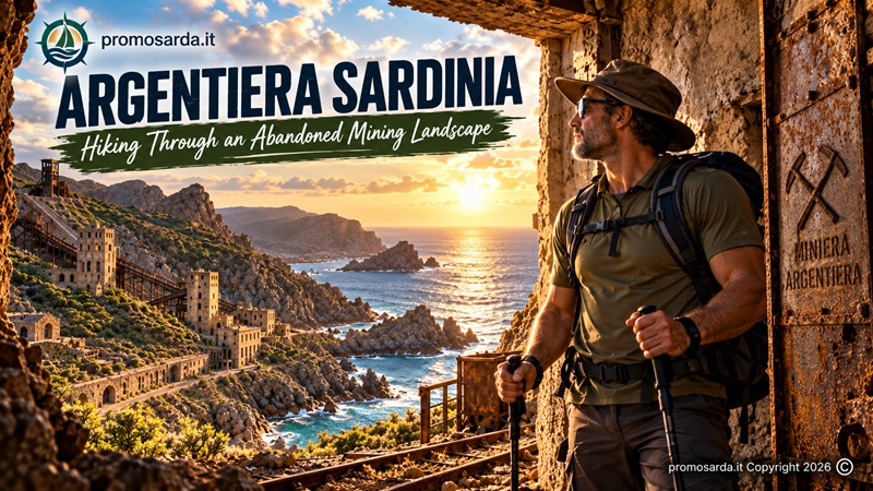
A practical guide to the old mine, coastal trails, industrial archaeology, Punta Argentiera and the strange, beautiful landscape between Alghero and Stintino
Some hikes are about reaching a summit. Argentiera is about reading the evidence left on the ground. A wall without a roof, black rock cut by a track, a rusted industrial structure, a pile of mineral waste, a road that appears to go nowhere: here, almost everything exists because somebody once needed to extract ore, move it, wash it, load it or live beside it.
This is exactly the sort of place I enjoy. Give me a dramatic coastline and I am happy; add an abandoned mine, old military structures and something whose original purpose is not immediately obvious and I start walking more slowly.
One correction before we begin: Argentiera is often described as a ghost town, but it is not literally abandoned. The mine is abandoned, much of its historical industrial infrastructure fell out of use and the settlement suffered severe depopulation, but people still live here. MAR-Miniera Argentiera currently puts the resident population at about 54. The mine operated until 1963 and the village is now undergoing a fascinating process of cultural and environmental regeneration.
Last checked: September 2026.
Argentiera Hiking: Quick Facts
| Where | Nurra coast, municipality of Sassari, north-west Sardinia |
| Best-known hike | Argentiera–Punta Argentiera coastal loop |
| Official 2026 guided route | Approx. 4 km |
| Official guided duration | Approx. 3–3.5 hours |
| Difficulty | Medium-high on the guided coastal route |
| Terrain | Rough trail, dirt track, Mediterranean scrub, rocky coast |
| Best months | March–June, late September–November |
| Summer | Dawn or late afternoon/sunset |
| Main interests | Industrial archaeology, geology, mining history, wildlife, military remains |
| Children | Official 2026 coastal excursion is not considered suitable for children |
| Pushchairs / reduced mobility | Not suitable on the rough coastal hiking route |
| Professional guide required? | Not for simply visiting the settlement; highly worthwhile for the full interpretive hike |
| My verdict | One of the most unusual half-day outdoor experiences in Northern Sardinia |
Why Argentiera Is Different from Almost Every Other Hike in Northern Sardinia
The obvious attraction is the contrast. You have Mediterranean scrub, cliffs and clear water, but behind them sit the remains of what was once Northern Sardinia’s most important mining district. The deposits contained zinc and argentiferous lead — lead ore carrying silver — which explains the name Argentiera rather better than imagining miners pulling large lumps of pure silver from the hillside. Mining activity was known here in Roman and medieval times, while modern industrial extraction resumed in 1867 and continued until 1963.
At its peak, the settlement grew to around 2,000 inhabitants. Houses, workshops, processing plants, administrative buildings and infrastructure developed around the extraction industry, while a pier at San Nicolò allowed ore to be loaded for transport by sea. In 1886 the mine passed to the Società di Correboi, which expanded and modernised operations; during the 1920s Pertusola took control and managed the mine until its final closure in 1963.
So when you walk here, the industrial archaeology is not decoration added beside the trail.
It created the trail.
A Small UNESCO Correction Worth Making
You will find older tourism material online describing the Sardinian Geo-mining Park — and sometimes Argentiera by extension — in ways that can easily be interpreted as meaning that it is currently a UNESCO World Heritage Site or UNESCO Global Geopark.
I would not write that.
Argentiera is part of the Parco Geominerario Storico e Ambientale della Sardegna, a national institution formally established in 2001. The Sardinian Geo-mining Park previously belonged to the UNESCO Global Geoparks network but did not obtain revalidation in 2019. In 2026, the Park began work towards a new candidacy to regain UNESCO Global Geopark status.
That does not make Argentiera less important.
It simply makes the description accurate.
The Best Argentiera Hike: Village to Punta Argentiera
The best current reference for a real hiking itinerary is the coastal loop used for official guided excursions in 2026. The Comune di Sassari describes a route beginning in the mining settlement, climbing through Mediterranean vegetation and continuing along the coast to Punta Argentiera. Along the way are cistus, broom, rosemary and lentisk, wildlife habitat, Lago delle Vergini, a small offshore island and an old military fort, before the route returns along the main dirt road. The official event version is around 4 km and 3½ hours, rated medium-high difficulty because the terrain is rough rather than because of extraordinary distance.
That last point is important.
Four kilometres sounds like nothing.
Four kilometres while stopping to interpret geology, mining remains, wildlife and industrial archaeology — over uneven terrain — is something else.
This is not a fitness challenge.
It is a landscape-reading exercise.
1. Start at the Laveria
I would begin around the Laveria, the symbolic heart of the former mine and now one of the focal points of MAR-Miniera Argentiera. The old processing complex makes the subsequent landscape much easier to understand because this was where ore ceased to be simply rock and became an industrial product.
The restored Open MAR experience has used former mining spaces for historical photographs, lamps, tools, clothing and interpretation of working life. Regional tourism material notes that women and children once worked separating valuable mineral material from waste in this processing environment.
Do this before the hike rather than afterwards if possible.
Once you know what the buildings did, the piles of rock outside stop looking random.
2. Leave the Industrial Landscape and Enter the Scrub
The official coastal route initially moves through Mediterranean vegetation. This transition is one of the things I like most about Argentiera: industrial infrastructure does not end cleanly at a museum fence. It gradually dissolves into cistus, broom, rosemary and lentisk.
Look behind you occasionally.
Hikers spend too much time staring in the direction they are walking.
From higher ground the geometry of the former mine begins to make more sense: coastline, settlement, processing area and roads all become parts of one system.
3. Punta Argentiera
The coastal section towards Punta Argentiera is where the outing becomes a proper hike rather than a heritage walk.
The terrain becomes rougher, the sea occupies more of the horizon and the village begins to feel remote despite never being very far away. The geology is also easier to read here, with dark coastal rock contrasting strongly with vegetation and water.
Regional tourism information notes that two dirt roads leave the Argentiera area towards the cape and Punta Argentiera, with a wilder network continuing along parts of the northern coast.
Gavino wouldn’t do this: assume every dirt track visible on satellite imagery is either a walking right-of-way or a legal 4×4 route. Industrial land, protected areas, private property and changing access conditions are exactly why I prefer current local information over old GPX tracks.
4. Lago delle Vergini
The Lago delle Vergini is one of the curiosities on the official 2026 coastal excursion. Combined with the nearby small island frequented by goats and rabbits, it changes the character of what many visitors expect to be simply an abandoned-mine walk.
This is also a good place to stop thinking about the buildings for a few minutes.
Argentiera’s landscape is not valuable only because miners altered it.
Nature kept working before, during and after them.
5. Wildlife Along the Route
The Comune di Sassari lists an unexpectedly varied fauna for the coastal route: yellow-legged gulls, Audouin’s gulls, ravens, vultures, foxes, wild boar and fallow deer may all occur in the wider landscape.
That does not mean you are going to tick all of them off in three hours.
Wildlife articles sometimes read like restaurant menus.
“Today: one vulture, two foxes and a boar.”
Nature does not take bookings.
Binoculars help. Silence helps more.
Leave it better: if approaching an animal changes what the animal is doing, you are already too close.
6. The Old Military Fort
The official route continues towards an old military fortification, with views opening towards Punta Cristallo and the Gulf of Porto Conte before the return along the principal dirt road.
This is where Argentiera becomes especially interesting for me.
Mining archaeology and military history occupy the same walk.
Do not enter unstable structures simply because a doorway is open. Ruins do not become safe through abandonment, and an old tunnel is not an invitation.
I explore.
I do not trespass for photographs.
Can You Hike Argentiera Without a Guide?
You can certainly explore the public settlement and accessible surrounding landscape independently. What I would not do is take the existence of the official 4 km guided itinerary as proof that every metre of that route is permanently signposted, maintained or independently accessible under all conditions.
The 2026 programme deliberately uses professional Guide Ambientali Escursionistiche, and MAR states that the precise summer itinerary can change according to route characteristics, season and environmental conditions.
That tells you something useful.
This landscape rewards interpretation.
A professional guide can explain why a structure was built, distinguish natural geology from mining waste, recognise wildlife and decide when a particular route is a bad idea.
Gavino is the Outdoor Guide of this website.
I am not trying to replace the woman or man who walks this exact terrain professionally.
MAR-Miniera Argentiera Guided Visits in 2026
The regeneration of Argentiera has changed the visitor experience substantially. MAR-Miniera Argentiera is now a hybrid cultural centre developed through LandWorks and local partners, using the former mining settlement for heritage interpretation, cultural programming and environmental activities.
For the 2026 season, guided Laveria visits run on weekends from 17 July to 6 September, last about 45 minutes, require reservation and are listed as free. Some of the final evening sessions are conducted with torches/headlamps to evoke the experience of working underground.
The 2026 hiking programme runs on Tuesdays and Sundays from 26 July to 6 September, alternating dawn and sunset outings. Participation is limited to 15 people, booking is compulsory, and MAR warns that the rough route is unsuitable for pushchairs, people with reduced mobility and children. Participants are asked to bring trekking shoes, water, snacks and insect repellent.
At the time of this update, the 2026 programme is reaching its final dates. Do not assume that the same timetable or pricing will apply in a future season.
Official MAR Argentiera guided visits and hikes
Is Argentiera Really a Ghost Town?
Not quite.
And I prefer the truth because it is more interesting.
The mine closed in 1963, population collapsed and a large portion of the industrial complex became unused. But Argentiera never ceased to be a place where people live. MAR currently describes around 54 residents, while abandoned structures now coexist with restored buildings, cultural projects and a very small active community.
So I use “abandoned mining landscape” freely.
I use “ghost town” only as shorthand for search intent, not as a literal description.
This is not Pompeii.
Someone may be having lunch behind the window you have just photographed.
What Happened to the Argentiera Mine?
The deposits were known in antiquity, with exploitation in Roman and medieval periods. Modern activity restarted in 1867, when a concession was granted for argentiferous lead and zinc. The mine expanded considerably from the late nineteenth century onwards, stimulating construction of workers’ housing, technical buildings, services and maritime loading facilities.
The Società di Correboi took control in 1886 and modernised both productive and residential infrastructure. Pertusola later controlled the operation until closure in 1963, which the official Geo-mining Park attributes to exhaustion of the deposit.
There is even a good cultural footnote: Honoré de Balzac came to the area in 1838 while pursuing dreams connected with Sardinian mineral wealth. The adventure did not make him a mining magnate.
I like that story.
Everybody needs at least one financial decision in life that looks better when described as literature.
The Laveria Is Not Just a Photogenic Ruin
If you remember only one industrial structure, remember the Laveria.
Ore processing was fundamental because extracting rock from a mountain is only the first part of mining. Material has to be sorted and concentrated before transport. The surviving structures therefore explain why the entire village existed.
That is also why I dislike seeing mining ruins used merely as Instagram backgrounds.
The building was somebody’s workplace.
The landscape around it was somebody’s economy.
And when the mine closed, the consequences were somebody’s unemployment.
MAR’s regeneration work is interesting precisely because it does not pretend the village should remain frozen in 1963. Its aim is conservation and reuse.
The Geology: Why Everything Looks Slightly Metallic
Argentiera sits among mineralised rocks and silver-grey slopes that help give the bay its distinctive appearance. The economic deposits were principally lead and zinc ores containing silver, rather than a fantasy-movie vein of pure silver.
Mining then added another visual layer: extraction waste, altered slopes, cuts, tracks and processing remains.
This means you need to be careful about another very human instinct.
“Interesting rock. Pocket.”
No.
Interesting does not mean portable.
Leave geological and historical material where it is.
What I Would Wear
For the full coastal hike: proper trekking shoes, hat, water, sunscreen, small first-aid kit, charged phone, offline mapping and a light wind layer. In warmer periods add more water than your optimistic side thinks necessary. The official organised hike additionally recommends snacks and insect repellent.
The route is short enough that people underestimate it.
That is usually when equipment matters most.
Nobody arrives for a 14 km mountain hike wearing flip-flops accidentally.
Four kilometres beside a beach?
Different story.
Best Time to Hike Argentiera
My first choices are April, May, October and November, with March and early June also very good depending on weather. Spring gives you vegetation and cooler temperatures; autumn often gives you warm sea air without peak summer heat.
July and August are possible, but I would copy the logic used by the professional 2026 programme: go at dawn or near sunset, not when the landscape is functioning as an oven. MAR specifically scheduled summer hikes at those cooler times.
Wind deserves attention too. This is an exposed western coastline. A strong maestrale can change a pleasant viewpoint into somewhere you stop admiring your hat because your hat is now travelling independently.
Can Children Do the Argentiera Hike?
For the official 2026 coastal hiking route, no: the organisers explicitly classify the terrain as rough and say it is not suitable for children, pushchairs or people with reduced mobility.
That does not mean families should avoid Argentiera entirely. The mining settlement, cultural areas and bay can still make a fascinating visit without committing to the rougher hiking circuit.
With children I would concentrate on heritage interpretation + village + short safe walks, then save the full Punta Argentiera trail for another day.
Can I Explore the Abandoned Buildings?
Treat unrestored industrial buildings, galleries, shafts and visibly unstable structures as off-limits unless a managed visit specifically gives access.
There are three separate issues here: safety, property/access rights and heritage conservation.
A broken window is not an entrance ticket.
Neither is a YouTube video of somebody else climbing through it.
I have crawled around enough outdoor places in my life to know that the most experienced decision is sometimes not entering.
What About a 4×4?
This coast is tempting if you own one.
Regional tourism material describes dirt-road access north and south of Argentiera and mentions stretches historically used by off-road vehicles, including tracks parallel to the northern cliffs.
That does not mean I advise driving every visible track.
Conditions, closures, land ownership and restrictions can change. A capable vehicle gives you options; it does not create permission.
My rule is simple: if there is any doubt, park where access is unquestionably legitimate and walk.
The machine is there to help me reach the landscape.
It is not there to prove I can defeat it.
Parking and Arrival
Argentiera lies in the municipality of Sassari, around 43 km from Sassari itself, reached through the Nurra and Palmadula area.
There is parking around the settlement and beach area, including an established parking area on Via La Plata. In high summer I would still arrive earlier than required for a guided excursion rather than treating the meeting time as the parking-arrival time.
If your excursion begins at the Laveria, go there first.
Do not park somewhere impressive and then discover that your guide is fifteen minutes away uphill.
Where to Eat After the Hike
Argentiera is small, so I would not build a culinary itinerary expecting fifteen competing restaurants.
For a proper meal in the settlement, Il Veliero2.0 is on Via Carbonia and currently sits around 4.2/5 from more than 500 reviews. It is the obvious convenient choice when the objective is “take boots off, find chair, eat.”
For a lighter stop by the coast, El Sombrero Chiosco Bar on Via La Plata currently rates around 4.4/5 from more than 200 reviews.
If you are returning through Palmadula, ELIS SUNSET SRL is another useful option, currently around 4.5/5.
Ratings are a snapshot from September 2026, not geological formations. Check again before travelling.
Where to Stay Around Argentiera
If the purpose of the trip is Argentiera itself, staying locally is more interesting than driving back to Alghero after sunset.
Residence Argentiera is directly in the village on Via Monteponi and currently rates around 4.3/5. That is my most practical choice for waking up inside the mining landscape.
Calata Di Soli is another small local option on Via Monteponi, currently around 4.4/5.
For a more rural base near Palmadula, Agriturismo Monte Allegru currently rates around 4.6/5 and makes more sense if Argentiera is one part of a wider Nurra outdoor trip rather than the only objective.
I would choose Argentiera for atmosphere, Palmadula/Nurra for flexibility, Alghero for restaurants and evening life.
Gavino’s Best Half-Day Plan
If you have roughly half a day, I would do this: arrive early → explore the Laveria/MAR area → walk the official or currently recommended coastal route towards Punta Argentiera → spend time at the military and natural viewpoints → return to the village → late lunch or early dinner.
If a professional guided hike is operating, I would structure the day around it instead of trying to reproduce its route independently.
That gives you history first, landscape second and food last.
Correct order.
The Full-Day Version
With a full day I would add Porto Palmas, around two kilometres south of Argentiera along the wider coastal area. It is a sheltered crescent-shaped bay backed by a rugged landscape and works very well as a post-hike decompression stop.
Do not add three more hikes just because daylight remains.
Sometimes the intelligent extension to a hike is sitting down.
The Two-Day Outdoor Version: Add Lago di Baratz and Porto Ferro
For a second day, move south-east towards Lago di Baratz and Porto Ferro.
Baratz is Sardinia’s only natural lake and is surrounded by woodland, wetlands and dunes. The area supports walking, MTB, horse riding and birdwatching, with several marked routes including a loop around the lake and links towards Porto Ferro.
That produces an excellent two-day contrast:
Day 1: mining archaeology, cliffs and industrial history at Argentiera.
Day 2: freshwater ecosystem, pine forest, dunes and wildlife at Baratz/Porto Ferro.
Same corner of Northern Sardinia.
Completely different outdoor experience.
That is exactly how I like building itineraries.
Is Argentiera Worth Visiting If You Don’t Hike?
Yes.
The mistake would be treating it as just a beach stop.
Walk through the former mining settlement, understand the Laveria, join a heritage visit when available, look at the relationship between buildings and topography, then continue to the bay.
Even thirty thoughtful minutes here tell you more about Northern Sardinia than another photograph of turquoise water.
And there is a lot of turquoise water.
It will survive without your 401st photograph.
What Not to Take Home
Mining landscapes produce irresistible little objects.
Pieces of unusual rock.
Rusty fragments.
Ceramic.
Glass.
Something that looks like a tool.
Something that might be old.
Leave them.
Apart from legal and conservation considerations, removing material destroys context. A rusty piece of metal sitting beside a specific structure may tell somebody who understands mining archaeology much more than that same metal sitting on your bookshelf.
I am an amateur archaeology enthusiast.
That has taught me one important lesson:
curiosity is not ownership.
If something appears genuinely archaeological or historically significant, document it without moving it and notify the appropriate heritage authority rather than conducting your own excavation with a trekking pole.
Leave It Better
Argentiera has undergone decades of abandonment and is now being actively regenerated.
That makes litter here especially irritating.
Someone restores a historic building.
Somebody clears a trail.
A professional guide spends years learning the landscape.
Then somebody leaves a plastic bottle beside the viewpoint.
I normally carry a small rubbish bag.
It weighs almost nothing when empty.
Unfortunately, it often weighs more on the way back.
Take your own waste. If you find one easy piece of somebody else’s near a heritage site, taking that too is not heroic environmentalism.
It is basic housekeeping.
Argentiera Hiking FAQ
How long is the Argentiera hike?
The official 2026 coastal guided route is approximately 4 km and takes around 3–3.5 hours, reflecting rough terrain and interpretive stops rather than long distance.
Is the Argentiera trail difficult?
The Comune di Sassari classified the 2026 coastal excursion as medium-high difficulty. It is short, but the terrain is uneven and rough.
Do I need a guide to visit Argentiera?
No guide is needed merely to visit the settlement and publicly accessible areas. For the complete coastal experience, however, a qualified local guide adds substantial value, and the current organised trail programme is specifically conducted by Guide Ambientali Escursionistiche.
Can you enter the Argentiera mine?
Do not assume abandoned galleries or structures are freely accessible. Use managed heritage visits where entry is explicitly permitted. MAR currently offers organised visits focused on the Laveria and mining history.
When did the Argentiera mine close?
1963. Modern extraction had resumed in 1867.
What was mined at Argentiera?
Primarily argentiferous lead and zinc deposits.
Is Argentiera abandoned?
The mining operation is abandoned and many historical buildings ceased their original use, but the settlement is not completely uninhabited. MAR reports roughly 54 residents today.
Is Argentiera a UNESCO World Heritage Site?
No. Argentiera forms part of Sardinia’s Geo-mining Historical and Environmental Park. The Park previously had UNESCO Global Geopark status, lost revalidation in 2019 and is working on a new candidature in 2026.
Can children hike at Argentiera?
The official 2026 coastal guided route is specifically described as unsuitable for children because of its rough terrain. A shorter heritage-focused visit to the settlement is a different proposition.
What is the best time to visit Argentiera?
For hiking, spring and autumn. In midsummer, use dawn or late afternoon/sunset and avoid the hottest part of the day.
Final Thoughts: Don’t Come Here Looking Only for Ruins
Calling Argentiera an abandoned mine is accurate but incomplete.
What makes the place worth walking is the sequence.
First geology creates mineral wealth. Then people exploit it. Roads appear. Buildings appear. Families arrive. Industry grows. The mineral runs out. The mine closes. People leave. Structures decay. Vegetation returns. A generation later, somebody decides the ruins are not useless after all and starts interpreting them as heritage.
Now hikers arrive.
That entire story is visible in a few kilometres.
I do not want Argentiera restored until it looks new.
I do not want it abandoned until everything collapses either.
The interesting balance is happening now: enough preservation to understand what happened, enough decay to understand that an era ended, and enough new activity to prove that the story did not.
Walk slowly.
Read the buildings.
Look behind you occasionally.
Stay out of places that are not safe or legal.
Leave the old objects where you found them.
And if somebody has left a bottle beside a piece of mining history that survived since your grandfather’s time, you know what I am going to say.
You have a backpack.
