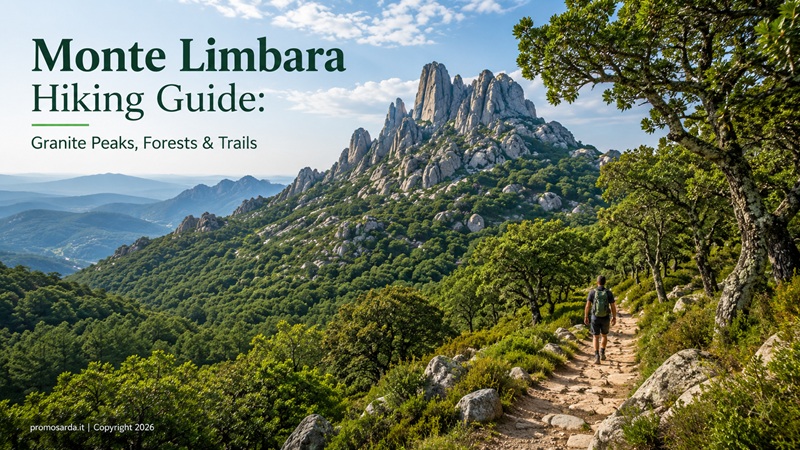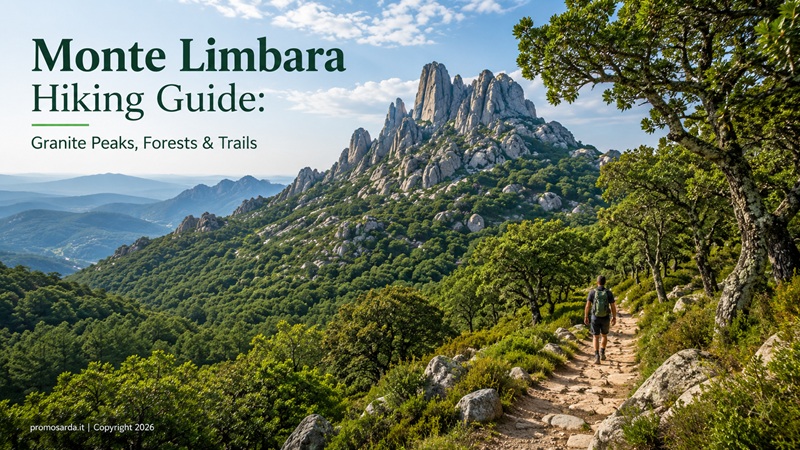
The best Monte Limbara hiking trails, from Vallicciola and Punta Bandera to granite arches, forest paths, springs and the highest landscapes of Gallura
My name is Gavino. I am from Nuoro, and Monte Limbara is one of those Sardinian mountains that can fool you the first time you visit. You drive up from Tempio Pausania on a proper road, arrive at Vallicciola, find parking, a fountain, picnic tables and enormous trees, and for a moment everything feels very civilised. Then you leave the road. Granite appears everywhere. The forest closes around you. Phone coverage becomes unreliable. Clouds arrive from nowhere. A perfectly dry slab becomes slippery after a little rain. Suddenly you remember that you are above 1,000 metres.
That is the Limbara I like.
I hike at moderate to moderately demanding level. I mountain bike, ride horses and own a small 4×4 that is useful for reaching remote places. I am The Outdoor Guide of this website, not a professional hiking guide taking paying clients. For ordinary marked trails I often walk independently; where conditions, navigation or technical difficulty justify it, I prefer somebody professionally qualified who knows the mountain better than I do.
Monte Limbara is different from most places visitors associate with Northern Sardinia. There is no turquoise cove at the end. Instead you get granite peaks, cork and holm-oak woodland, reforested conifer forests, springs, tafoni, huge weathered rock formations, old pastoral shelters, military communications history and views that can extend from inland Sardinia to La Maddalena and even Corsica on exceptionally clear days. The massif occupies the borderland between Gallura and the territories immediately to the south, and its vegetation changes markedly with elevation.
This is also a guide where checking current trail information genuinely matters. The official Sardegna Sentieri / RES catalogue currently marks some important Limbara routes as Percorribile, while others remain In verifica o Manutenzione. I will tell you which is which rather than pretending an old GPX file has authority over Forestas.
Monte Limbara at a Glance
| Trail / Area | Distance | Official time | Elevation gain | Current RES status | My verdict |
|---|---|---|---|---|---|
| F-402 Vallicciola → Punta Bandera | 4.6 km one way | 1h 45 | 322 m | Percorribile | Best first summit-area hike |
| F-401 Curadoreddu → Punta Bandera | 9 km one way | 3h 30 | 841 m | Percorribile | Best demanding ascent |
| F-404 Fossu Lu Pisciaroni → Vallicciola | 2.9 km | 1h 30 | — | Percorribile | Useful forest connector |
| F-405 Funtana Li Frati → Lu Paggiolu | 6.8 km | 2h 30 | 562 m | Percorribile | Excellent wooded hike |
| F-406 Fonte Li Frati → Sarra Lu Tassu | 4.6 km | 2 h | 483 m | Percorribile | Tafoni + forest |
| F-407A Li Reni → Li Conchi | 1 km | 30 min | 117 m | Percorribile | Short tafoni detour |
| F-403 Sa Soliana → Punta Bandera | 8.1 km | 3h 30 | 823 m | In verifica/manutenzione | Check before planning |
| F-407 La Suliana → Bucaticci | 3.2 km | 1h 30 | 340 m | In verifica/manutenzione | Not my current first choice |
Official distances and status are from the regional RES/Forestas trail network. Several are linear rather than circular, so a 4.6 km trail does not magically return you to your car.
Where Is Monte Limbara?
The massif rises behind Tempio Pausania and Calangianus, extending south towards Berchidda and the Monteacuto side. For hiking purposes, the RES system usefully distinguishes the North Limbara sector around Tempio/Calangianus from the South Limbara side towards Berchidda.
Tempio is my preferred base. You finish a trail and return to a real Gallurese town rather than a resort: granite streets, cafés, restaurants, natural springs and easy access to Nuragic and cork-culture sites. The city’s own tourism service presents Monte Limbara as one of Tempio’s principal outdoor landscapes.
How High Is Monte Limbara? A Small Sardinian Argument
You will find contradictory numbers online.
Some sources call Punta Balistreri, around 1,359 metres, the highest summit. Other current regional tourism material identifies Punta Sa Berritta at 1,362 metres as the highest point, followed closely by Balistreri and Punta Bandiera. The dedicated SardegnaTurismo page for Sa Berritta explicitly gives Sa Berritta 1,362 m, Balistreri 1,359 m and Bandiera 1,345 m.
Even official tourism pages are not perfectly consistent about this, while the Aeronautica Militare records its Punta Balistreri meteorological station at approximately 1,363 m because station elevation and summit/topographic references are not necessarily being measured identically.
My practical solution?
I do not start a fight over three metres.
You are walking the high Limbara ridge, with several summits clustered around 1,300–1,360 metres. The experience matters considerably more than whether one granite block has defeated another by three metres.
Vallicciola — The Best Place to Understand the Mountain Before Hiking It
For most first-time visitors, Vallicciola is the logical starting point.
It sits at roughly 1,050–1,056 metres, reached from Tempio via the SS392 and the winding road climbing onto Limbara. There is parking, a fountain, picnic infrastructure and other visitor facilities, making it far easier logistically than many Sardinian mountain trailheads.
Then there are the trees.
The Giant Sequoias of Vallicciola
Yes.
Sequoias.
On a Sardinian mountain.
Vallicciola contains one of Italy’s unusual concentrations of Sequoiadendron giganteum. Cultural-heritage documentation describes nineteen specimens near the fountain and another eight around the hotel area; the latest Sardinian monumental-tree register lists the Vallicciola group, with recorded average heights around 29 metres and maximum examples reaching approximately 35 metres.
They are not native Sardinian forest.
That is precisely why they are interesting.
Vallicciola’s arboretum developed from forestry experimentation beginning in the twentieth century; the Pavari garden contains exotic species introduced as part of this history.
Gavino’s advice: do not rush straight from the car to the trail marker. Spend ten minutes around Vallicciola first. You are looking at another chapter in Sardinia’s relationship with forests.
1. F-402 Vallicciola to Punta Bandera — The Trail I Recommend First
4.6 km one way | 1h 45 official time | 322 m total ascent | E / hiking level | Current status: Percorribile
If somebody asks me:
“Gavino, I have one good morning on Monte Limbara. Which trail?”
This one.
F-402 starts at Vallicciola and moves through conifer forest before leaving the easier woodland tracks for rockier terrain. It climbs towards Punta Giogantinu, reaches the Madonna della Neve area, passes close to the Suprappare granite arch and eventually reaches the high plateau and junction towards Punta Bandera. The official route reaches about 1,335 metres maximum elevation before the final connection.
It is rated E — Escursionistico, not a casual tourist path. RES currently warns about slippery granite, fog, strong wind, water scarcity and vegetation that can partially obscure the route.
That combination describes Limbara very well.
Nothing individually sounds dramatic.
Together, in bad weather, they matter.
Why I like F-402
The route changes continuously: forest, open granite, high plateau, religious landmark, natural monument and huge views. It gives you a compressed version of the mountain without forcing you into one of the longer ascents from much lower altitude.
And it is currently listed as Percorribile.
That matters to me.
Remember the return
F-402 is 4.6 km one way.
If you return substantially by the same route, think approximately 9.2 km, plus your diversions and summit wandering.
Official time to Punta Bandera is 1h45. My own planning would allow a comfortable half day rather than trying to complete an out-and-back according to multiplication on a calculator.
I stop.
Apparently more often than trail signs do.
The Madonna della Neve
The little granite Church of Madonna della Neve provides one of the route’s cultural pauses.
The current building was reconstructed in 1994 on the remains of an earlier church dating to 1900, using exposed granite and the forms of traditional Gallurese rural churches.
I like finding this on a mountain because it reminds you that Limbara has never been an empty “natural” space.
Foresters.
Shepherds.
Soldiers.
Local families.
Pilgrims.
Hikers.
Different people have used the same mountain for very different reasons.
Punta Sa Berritta and the Suprappare Granite Arch
This is one of the reasons I bring people to the summit sector.
Punta Sa Berritta and the nearby Suprappare rock arch form a registered natural monument. The arch is approximately 14 metres long, up to six metres high and around 3.5 metres thick, an unusually large natural granite arch for Sardinia.
Wind and water have done the sculpting.
No Nuragic engineers required.
I mention that because my interest in archaeology occasionally makes friends assume every unusual rock formation has to be human.
It doesn’t.
Sometimes geology has better imagination.
Gavino’s detour: the RES F-402 description recommends the short deviation to the arch from the Madonna della Neve sector. Take it. Ten minutes here are worth considerably more than ten minutes spent trying to beat your estimated arrival time.
2. F-401 Curadoreddu to Punta Bandera — The Proper Ascent
9 km one way | 3h 30 official time | 841 m total elevation gain | E | Current status: Percorribile
Now we are hiking.
F-401 begins near Curadoreddu, from the SS392 side, at only about 560 metres and climbs towards Punta Bandera. It passes through forest, the Oltu di li Pomi area, Bucaticci and the higher trail network before eventually meeting the summit-sector paths.
The official numbers immediately separate this from F-402:
9 km one way.
841 metres total elevation gain.
3h 30 official ascent time.
And unless you have arranged a second vehicle or another legitimate transfer plan, you still need to get back.
That can make this a serious full day.
Who should choose it?
Someone who came specifically to hike Monte Limbara, rather than someone who wants a scenic mountain morning.
For a fit, experienced recreational hiker in good conditions, this is a satisfying route.
For somebody whose last hike was a promenade between two beaches, choose Vallicciola.
The mountain will not feel insulted.
Current status
F-401 is currently listed as Percorribile. Forestas and CAI Sassari previously carried out trail and signage maintenance, although the trail documentation still notes the continuing process of replacing older signs with the RES system.
I carry the GPX anyway.
Signage and navigation are friends.
Not alternatives.
3. F-405 Funtana Li Frati to Lu Paggiolu — My Forest Choice
6.8 km | 2h 30 | 562 m ascent | E | Current status: Percorribile
This is one of the routes I recommend when someone says:
“I want Limbara, but I prefer forest to open ridge.”
F-405 begins at Funtana Li Frati, around 538 metres. The area has a fountain and picnic space, then the route climbs steeply into holm-oak forest towards Coddhu d’Abba Fritta, crosses the F-404 network, reaches around 1,100 metres near Cacaeddu and continues through Buttaru di Juncu and Suliana towards Lu Paggiolu.
Much of it is shaded.
Do not translate that as flat.
The trail gains more than 500 metres.
What makes it interesting?
Granite boulders.
Forest.
Springs.
Old Gallurese place names.
And a feeling of being inside the mountain rather than standing on top of it.
The starting area is also associated with bouldering on the granite blocks, although that belongs to a different specialist activity and I would not give technical climbing advice here.
Current RES status is Percorribile, with warnings about slippery rocks and vegetation. Parts of the route also lack telephone coverage.
Gavino wouldn’t do this: assume that a shaded trail means you can carry less water. Shade reduces heat. It does not create water inside your bottle.
4. F-406 Fonte Li Frati to Sarra Lu Tassu — The Tafoni Trail
4.6 km | 2 h | 483 m ascent | E | Current status: Percorribile
F-406 begins from the same general Fonte Li Frati area and quickly introduces one of Limbara’s most characteristic geological features: tafoni, the natural cavities weathered into granite.
The most famous group on this route is called “la Prisgione”. These cavities have historically been used as shelters for flocks and probably also by shepherds. The route then climbs beside Rio Mulinu, reaches Buttaru di Juncu, crosses the F-405 network and continues through forest towards Sarra Lu Tassu.
This is exactly my type of walk.
Natural geology becomes human shelter.
Not necessarily archaeology.
Not necessarily a monument.
But evidence of how people adapted existing landscape rather than always building something new.
Current status
Percorribile.
The official trail information nevertheless warns that some sections have no phone service, vegetation may obscure the path and intense weather can produce hydrogeological danger.
Four-point-six kilometres.
Almost 500 metres of ascent.
Again:
distance alone tells you very little.
5. F-404 Fossu Lu Pisciaroni to Vallicciola — Short Connector, Useful Route
2.9 km | 1h 30 | E | Current status: Percorribile
F-404 runs between Fossu Lu Pisciaroni and Vallicciola, connecting into F-401 and giving hikers a way to construct more interesting combinations through North Limbara. The route passes Oltu di Li Pomi and climbs towards the well-serviced Vallicciola area.
I would not travel across Sardinia specifically for F-404.
That is not criticism.
Connectors matter.
Without them, trail networks become isolated lines rather than something you can intelligently combine.
For somebody spending several days around Tempio, F-404 opens alternatives to simply repeating the summit route.
6. F-407A Li Reni to Li Conchi — One Kilometre I Would Actually Make the Detour For
1 km | 30 min | 117 m | E | Current status: Percorribile
Normally I would not give a one-kilometre trail its own section.
Li Conchi earns it.
F-407A branches towards an area filled with tafoni, locally called conchi, and also connects the Limbara system to the Sentiero Italia network. The route requires crossing a stream near the beginning; in periods when that crossing is difficult, the official trail description identifies an alternative using the forest-road bridge.
Why I like Li Conchi
People used these natural granite cavities as livestock shelters and probably as temporary human shelter as well.
It is the kind of place where I have to control my amateur-archaeologist brain.
A cavity is not automatically prehistoric housing.
A blackened surface is not automatically an ancient hearth.
Interesting places deserve curiosity.
They also deserve restraint.
Trails I Would Check Before Using in 2026
This is where this guide earns its maintenance.
F-403 Sa Soliana → Punta Bandera
It sounds excellent: 8.1 km, around 823 m total elevation gain, climbing from the Berchidda side towards Punta Bandera. But the current RES listing marks F-403 In verifica o Manutenzione. It also warns of wild boar, slippery rock, flooding, lightning, fog and vegetation obstructing the trail; some sections have no mobile coverage.
So I do not currently present it as:
“Go here tomorrow.”
I present it as:
“Excellent route to reconsider after checking the current RES status.”
That is a better guide.
F-407 La Suliana → Bucaticci
Same principle.
F-407 is 3.2 km, roughly 1h30, E-level, but currently listed In verifica o Manutenzione.
Its network role is useful because it connects towards Li Reni, Li Conchi, F-401 and other North Limbara paths.
When validation returns to full Percorribile, it becomes more interesting for route-building.
Until then, I prefer F-402, F-401, F-405 or F-406.
What About Punta Balistreri?
You can reach the high summit area by road and by combinations of hiking routes, but do not think of Punta Balistreri as a pristine lonely summit.
The top has a very different history.
It became an important communications location, including a former NATO/US military relay installation and later Italian military communications infrastructure. Aeronautica Militare documentation still records an automatic meteorological station at Punta Balistreri and describes the summit’s concentration of telecommunications installations.
SardegnaTurismo likewise notes the summit’s communications-base history.
Some people dislike the antennas.
I find them historically interesting.
Mountain landscapes collect layers.
Pastoral.
Forestry.
Religious.
Military.
Recreational.
Limbara has all of them.
Gavino wouldn’t do this: cross fencing or enter restricted installations because something looks abandoned. “Old military structure” is not a synonym for “public access”.
The Forest Is Not Entirely Ancient
This is another useful piece of context.
Lower and intermediate Limbara support cork oak, holm oak, ash and other Mediterranean/montane vegetation, while higher elevations transition towards lower scrub, juniper, helichrysum and other plants adapted to more exposed conditions. Parts of the conifer forest reflect twentieth-century reforestation following fires and forest degradation.
Vallicciola makes this particularly obvious.
You can stand among native Mediterranean vegetation and then walk into an arboretum containing giant American sequoias.
Nature and human intervention are intertwined here.
Recognising that does not make the forest less beautiful.
It makes it more interesting.
Wildlife: What You Might See
Limbara supports wild boar, martens, weasels, wild cats, hares and other mammals, while mouflon and fallow deer have been reintroduced in the massif. Raptors include peregrine falcons and golden eagles, alongside woodland birds such as jays and woodpeckers.
Will you see an eagle?
Maybe.
Will you see a mouflon?
Maybe.
Will you see a wild boar because the official route warning says wild boar?
Possibly.
None of them has accepted a tourism contract.
Gavino’s wildlife rule
Stop.
Watch.
Do not follow.
If the animal leaves because of you, you were too close.
Wild Boar: What I Actually Do
I do not panic because a trail mentions wild boar.
I also do not walk quietly towards piglets because they look cute.
Make normal human noise when visibility is poor. Do not corner an animal. Give it space and an escape direction. Keep food packed.
Dogs change wildlife encounters substantially, so they require considerably more control than somebody casually walking alone.
And if vegetation is dense enough that visibility becomes poor, that is another reason to keep awareness outside your phone screen.
Best Time to Hike Monte Limbara
For me the strongest months are April, May, June, September, October and early November.
April–May
Probably the prettiest period.
Green forest.
Water in the landscape.
Comfortable temperatures.
Longer days.
June
Excellent, especially in shaded northern routes and with early starts.
July–August
Limbara can be considerably cooler than the coast, and shaded trails such as F-405 can remain attractive, but I still avoid treating altitude as air conditioning. The official F-405 description explicitly notes the heavy shade and suitability into summer, but ridge routes remain exposed to sun and weather.
Start early.
Check fire and access notices.
September–October
My other favourite.
Warm days.
Cooler mornings.
Less coastal tourism pressure.
November
Good on stable days.
Shorter daylight.
Weather matters more.
Winter
Beautiful when conditions cooperate.
But fog, rain, occasional snow/ice and wet granite change the difficulty enormously.
A route classified E in dry May conditions is still called E in January.
The rock has not read the classification.
Fog Is a Real Limbara Problem
I have had days on Sardinian mountains where the forecast promised broad views and fifteen minutes later I was looking at grey cloud.
Limbara does this well.
F-402 specifically warns that dense fog is common around the summit, and both summit and southern trails note rapid weather change and hydrogeological problems during severe conditions.
This matters because granite landscapes can become surprisingly confusing when the horizon disappears.
Carry:
offline map,
GPX,
charged phone,
power bank,
and enough common sense to turn around.
Navigation apps are tools.
Fog does not care what subscription plan you bought.
Water: Lots of Springs Does Not Mean No Water Planning
Historical/tourism descriptions identify an unusually rich network of springs around Limbara — approximately 29 recorded springs and fountains in some trail documentation.
You will see fountains at places such as Vallicciola and Fonte Li Frati.
Still:
I leave with water.
A fountain can be dry.
A route can change.
A source shown on an old map is not a hydration guarantee.
At Vallicciola, the established visitor area has a fountain and refreshment facilities.
That is where I fill up.
Not where I decide I no longer need to carry anything.
What I Carry
For the normal E-level routes in stable conditions: hiking shoes with proper grip, water, food, hat/sun protection, windproof layer, light insulating layer outside summer, small first-aid kit, offline mapping, downloaded RES GPX where available, charged phone, power bank and small torch.
I also carry the famous rubbish bag.
Limbara picnic areas can be busy.
Most visitors behave well.
Some apparently believe a used tissue becomes part of the forest ecosystem after ten minutes.
It doesn’t.
Can Children Hike Monte Limbara?
Yes.
But I would not start with F-401.
For a family introduction, use Vallicciola itself, the sequoias, picnic area and short surrounding explorations. Then try a portion of F-402 according to the child’s experience and weather rather than deciding the summit is compulsory.
The landscape already gives children:
huge trees,
granite shapes,
little church,
forest,
rocks,
possible wildlife.
That is enough.
A child’s successful three-kilometre mountain walk is better than an adult’s failed nine-kilometre educational programme.
Is Monte Limbara Good for Beginners?
Yes, if you choose the route correctly.
Best beginner experience: Vallicciola + short F-402 exploration.
Reasonably fit recreational walker: full F-402 out-and-back.
Experienced moderate hiker: F-405 or F-406.
Fit hiker wanting a proper ascent: F-401.
Route I currently would not select without fresh verification: F-403 or F-407 because of their RES validation state.
Difficulty is not a moral ranking.
There is no medal for selecting the longest line in the table.
Should You Hire a Guide?
For F-402 in good conditions, an experienced walker comfortable with GPX/navigation may not need one.
For less obvious route combinations, poor visibility, specialist naturalistic interpretation or somebody who simply wants to stop navigating and start observing, professional accompaniment can be valuable.
I do not invent a guide recommendation merely because an article needs an affiliate box. If I cannot verify that an operator genuinely works that exact route, I would rather tell you to consult the official regional guide registers or the Tempio territorial trail office / Forestas, whose contact for the RES network is published through Sardegna Sentieri.
That is more useful than sending you to somebody who normally guides forty kilometres away.
Driving to the Trailheads — And My 4×4 Rule
Vallicciola is straightforward by road.
Other trailheads can involve forest tracks or unpaved approaches. For example, the F-403 access from Berchidda eventually uses an unpaved forest road, and the official trail description explicitly says to check locally whether the final road section is passable by car.
That sentence could have been written for me. I own a 4×4.
I do not interpret:
“My car can physically get through”
as:
“I should drive through.”
Wet forest road? Park earlier. Erosion? Park earlier. Barrier? Stop. Fire restriction? Stop. Private/closed track? Stop.
Walking another kilometre is generally cheaper than repairing both a track and a vehicle.
MTB on Monte Limbara
We already discuss Limbara in Mountain Biking in Northern Sardinia: Best MTB & Gravel Routes, but one point deserves repeating.
Do not assume a hiking trail is automatically an MTB trail.
For example, current F-402 documentation lists Hiking and High Routes, not mountain biking.
There are forest roads and cycling possibilities across Limbara, and regional tourism material describes the massif as accessible for MTB, but the exact route needs to be checked against current access and classification rather than simply following somebody else’s Strava track.
GPX shows movement.
It does not create permission.
Climbing and Bouldering
Limbara has a real climbing tradition. SardegnaTurismo notes that climbing activity on the massif dates back to the early twentieth century, while the landscape contains granite suitable for traditional/clean climbing. Permanent modification of rock through artificial fixed installations is restricted in the protected landscape described by current tourism guidance.
Funtana Li Frati also has bouldering rocks beside the hiking network.
But this is a hiking guide.
For climbing, I would want a specialist contributor or qualified instructor reviewing the technical content.
Being interested in a mountain does not qualify me to teach every sport practised on it.
The Archaeology Detour: Nuraghe Majori
This is the cultural stop I would attach to almost every Limbara trip.
Nuraghe Majori lies roughly two kilometres outside Tempio, at around 498 metres altitude, inside mixed woodland. It is built entirely from granite and occupies a strategic position from which numerous other Nuragic monuments in the surrounding landscape can be identified.
We already included it in Northern Sardinia Archaeology Road Trip: Nuraghi, Tombs & Prehistoric Sites.
Here it serves a different purpose.
Spend the morning walking on granite.
Then look at what Bronze Age people built from granite.
Same geology.
Different use.
The site is also home to bats, so treat the interior as both cultural heritage and living habitat.
This is a place where archaeology and nature are literally occupying the same stones.
Calangianus: Understand the Cork Forest
The other cultural detour I recommend is Calangianus.
If you spend a day walking among cork oaks and then drive away without understanding why cork matters economically and culturally in Gallura, you have missed part of the landscape.
The Museo del Sughero in the former Capuchin convent explains the production process from bark extraction to finished objects and documents the industry’s enormous importance to Calangianus from the nineteenth century onward. Current published hours are Monday–Saturday 10:00–18:00 and Sunday 10:00–17:00, although I would still check before making a special journey.
This is a perfect rainy-afternoon complement to the mountain.
Hiking tells you what a cork oak woodland feels like.
The museum tells you why generations cared about it.
Tempio Pausania After the Hike
Do not finish Limbara and immediately drive back to the coast.
Tempio deserves the evening.
The old centre is characterised by grey-granite architecture, with the cathedral, old churches, streets and natural-spring culture reflecting a Gallura very different from Costa Smeralda.
This is one reason I keep pushing the “beyond the beaches” theme.
Forty-five minutes earlier you can be standing among summit granite and fog.
Then you are drinking something in a proper town.
Where I Would Eat After Hiking
For a traditional, substantial dinner I would consider La Gallurese, Via Novara 2, Tempio Pausania, currently rated 4.4/5. Another strong central choice is Trattoria Bisson, Via San Luca 18, currently 4.7/5. For something more contemporary and inexpensive, Acqua e Farina da Cossu at Via Amsicora 18 currently sits around 4.9/5.
And if I wanted the dinner to become part of the accommodation experience, Al Vecchio Corso Locanda at Via Roma 96 combines lodging and restaurant and currently carries a very strong public rating.
I choose after the hike.
Before the hike, almost everything sounds sensible.
After fourteen kilometres, the body becomes a more competent restaurant critic.
Where I Would Stay
If your main objective is two or three Limbara hikes, I stay around Tempio rather than commute from the coast.
For a central B&B, B&B Il Gallo di Gallura on Corso Giacomo Matteotti 28 is currently rated around 4.6/5. For a countryside base, Agriturismo La Cerra Tempio Pausania on the SS133 outside Tempio is currently around 4.8/5 and makes more sense for somebody whose priority is rural Gallura rather than being able to walk to every evening restaurant.
Gavino likes organised campsites.
I am not going to invent a “best Limbara campsite” because I do not currently have a directly relevant nearby campground clearing the quality threshold we use for this site strongly enough to recommend it over those alternatives.
Sometimes the correct recommendation is:
I don’t have one yet.
That is preferable to filling a section.
A Perfect Two-Day Monte Limbara Trip
Day 1: arrive at Vallicciola early; see the giant sequoias; hike F-402 towards Madonna della Neve, Suprappare and Punta Bandera; return with plenty of daylight; descend to Tempio; dinner in town.
Day 2: choose F-405 or F-406 for a more forested hike from the Li Frati sector; afterward visit Nuraghe Majori. If the weather collapses, substitute the hike with Calangianus and the Cork Museum rather than spending six hours proving you are waterproof.
For a third day, fit hikers can tackle F-401 with appropriate return logistics.
That gives you three different Limbara personalities:
summit,
forest,
full ascent.
Enough to understand the mountain.
A Word About Fire
Forest means fire risk.
During Sardinian summer, restrictions can change rapidly according to wildfire conditions and firefighting operations. Vallicciola itself includes important forest/fire-management infrastructure. Do not move barriers. Do not park where emergency access is required. Do not light fires. Do not throw cigarette ends.
And when official authorities close an area because of wildfire risk, a GPX track is not an appeal process.
Monte Limbara Hiking FAQ
What is the best hike on Monte Limbara?
For most first-time visitors, F-402 from Vallicciola to Punta Bandera. It combines manageable distance, high-mountain scenery, forest, Madonna della Neve and easy access to the Suprappare natural monument. It is also currently listed as Percorribile.
How long is the Vallicciola to Punta Bandera hike?
F-402 is 4.6 km one way, with an official walking time of 1h45 and total elevation gain of 322 metres. Returning substantially by the same route produces roughly a 9.2 km outing before diversions.
What is the hardest Monte Limbara trail in this guide?
Among the routes currently recommended, F-401 is the most substantial: 9 km one way with 841 metres of total elevation gain and an official 3h30 ascent time.
Is Monte Limbara suitable for beginners?
Yes around Vallicciola and on carefully selected shorter sections. A full F-401 ascent is not my beginner recommendation.
Is Punta Balistreri the highest summit?
Sources disagree slightly. Current SardegnaTurismo information dedicated to Punta Sa Berritta gives Sa Berritta 1,362 m and Balistreri 1,359 m. I treat the upper Limbara as a cluster of summits rather than making three metres the purpose of the walk.
Can you drive up Monte Limbara?
Road access reaches Vallicciola and continues into the summit area, although exact access around installations and forestry roads must be respected. Driving to altitude and hiking from there is a perfectly reasonable way to experience the massif.
Is F-403 open?
The current RES listing marks Sa Soliana–Punta Bandera F-403 as In verifica o Manutenzione, so I would check its current status before planning it.
Is F-407 open?
It currently carries the same In verifica o Manutenzione status.
Can you hike Monte Limbara in summer?
Yes, especially early in the day and on forested routes, but heat and wildfire conditions still matter. Higher open ridges have less protection than shaded forest trails.
Can it snow on Monte Limbara?
Winter snow and icy conditions can occur at altitude, while fog, wet granite and strong wind can substantially change trail difficulty.
Is there water on Monte Limbara?
There are numerous springs and fountains around the massif, including facilities at Vallicciola and Li Frati, but I still carry enough water for the planned hike.
Are there giant sequoias on Monte Limbara?
Yes. Vallicciola contains a notable group of giant sequoias included in Sardinia’s monumental-tree documentation.
Can I hike Monte Limbara without a guide?
Experienced recreational hikers can independently use appropriate marked routes in suitable conditions. Carry current RES information and navigation. A qualified professional guide makes sense if you lack navigation experience, want specialist interpretation or conditions make route-finding uncertain.
Is Monte Limbara good for children?
Vallicciola and short surrounding walks are excellent. Choose longer E-level trails according to the child’s actual mountain experience, not age alone.
What should I visit near Monte Limbara?
My first choices are Tempio Pausania, Nuraghe Majori and Calangianus with its Cork Museum. These turn the hike into an introduction to Gallura rather than an isolated outdoor activity.
Final Thoughts: Limbara Is the Mountain That Changes Northern Sardinia
People arrive in Northern Sardinia thinking horizontally. Coast. Beach. Road. Another beach.
Then you go up Limbara.
The horizon changes. Temperature changes. Vegetation changes. Granite that appeared beside roads in Gallura becomes the entire landscape. You pass enormous sequoias planted by people. Native woodland. Tafoni used as shelters. A small granite church. Old military communications infrastructure. Springs. Rock arches created without anybody’s help.
And if the cloud comes down, you may see almost none of the panorama you came for. That is fine. I have learned not to demand that mountains perform.
I check the trail status. I check the weather. I carry the GPX. I take enough water. If a path is in maintenance, I choose another. If the granite is wet, I slow down. If fog becomes too thick, I turn.
And when I return to the car, if somebody has left a plastic bottle near the picnic table, it normally comes back down with me.
The first time I visited a place like Vallicciola, somebody had already done the work that allowed me to enjoy it: foresters maintained the road, somebody marked the path, somebody protected the trees, somebody carried rubbish away.
A mountain does not remain beautiful by accident. Neither does a trail. Walk it. Respect it.
Then go into Tempio and eat properly.
You earned that part.