The Nurra Region and Asinara Island
The Historic Nurra Region
The Nurra (anciently known as Nure) was historically a curatoria of the Giudicato of Torres. Located in the extreme northwestern portion of Sardinia, it forms a quadrilateral bounded by the Gulf of Asinara to the northeast, the Sea of Sardinia to the west, the Rio Mannu to the east, and the Logudoro hills to the southeast.
-
Territory & Municipalities: The region includes the municipalities of Alghero, Olmedo, Porto Torres, Stintino, and numerous hamlets of Sassari.
-
Landscape: Mostly flat and sparsely populated, the landscape preserves remnants of scattered rural settlements (cuiles), which were historically built by shepherds and farmers as shelters for livestock. Its highest elevations are Monte Forte (464 meters) and Monte Doglia (437 meters).
-
Economy: Built upon agriculture (aided by historical land reclamation), sheep farming, fishing, coastal tourism, and historic mining activities—such as lead and zinc extraction at Argentiera and iron mining at Canaglia.
Isola Piana and the Finanza Tower
Located in the Fornelli Strait facing Asinara, Isola Piana is a completely flat island that was once owned by the Berlinguer family before being donated to the Italian State under the condition that it remain in its natural state.
-
Cala Grande: Situated on the island’s eastern side, this inlet features remarkably clear waters.
-
Torre della Finanza: Standing 3 meters above sea level and reaching a height of 18 meters, this cylindrical schist tower was built during the Spanish period between 1525 and 1531 and restored in 1578. The two-story structure features a vaulted ceiling, a central pillar, and internal staircases leading to the rooftop terrace.
Asinara Island
Asinara is the second-largest satellite island of Sardinia (after Sant’Antioco) and forms part of the municipality of Porto Torres.
Environment, Flora, and Fauna
The island features a preserved Mediterranean landscape dominated by low-lying maquis, mastic, myrtle, rosemary, and Phoenician junipers, with its only significant tree grove being a holm-oak forest at Elighe Mannu in the north. The surrounding coastal waters host extensive meadows of Posidonia oceanica, a sensitive marine plant species that acts as a vital biological indicator of water quality. Rare endemic flora includes Centaurea horrida and Thymelaea.
The island’s isolated ecosystem supports varied animal life:
-
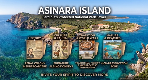
The Albino Donkey (Asinello Bianco): The island’s signature inhabitant—a unique feral albino donkey population characterized by pale coats and light sensitivity.
-
Feral & Wild Species: Includes Sardinian donkeys, wild horses, boars, feral cattle, and a population of roughly 300 mouflons.
-
Birdlife & Marine Fauna: Home to buzzards, peregrine falcons, storm petrels, and sea swallows. The shallow waters at places like Cala Marcutza and Cala Trabuccato support extensive populations of the Pinna nobilis (noble pen shell), the largest bivalve mollusk in the Mediterranean Sea.
History
-
Eviction & Penal Settlement (1885): In 1885, the island became state property. Its resident Sardinian farmers and Genoese fishermen were relocated to the mainland, where they founded the town of Stintino. The island was subsequently converted into a penal colony and quarantine station, functioning for 112 years until its official closure in December 1997.
-
High-Security Era: During its operation as a high-security prison (supercarcere), it housed political prisoners, Brigate Rosse members, and high-profile mafia figures under the 41-bis regime (such as Totò Riina and Leoluca Bagarella). Throughout its history, only two inmates (Matteo Boe and Salvatore Duras in 1986) ever successfully escaped.
-
Falcone and Borsellino: In the summer of 1985, anti-mafia judges Giovanni Falcone and Paolo Borsellino were housed at the guesthouse in Cala d’Oliva for security while preparing the indictment for the historic Maxiprocesso.
-
National Park Creation: Established as a National Park in 1991 and opened to restricted, guided tourism in 1999 to protect its fragile terrestrial and marine environments from commercial overdevelopment.
Notable Locations and Historical Landmarks on Asinara
Fornelli
Situated in the southern plain of the island, Fornelli was the location of the original prison facilities and maximum-security “bunker” structure, as well as a former tuberculosis hospital used during World War II.
Santa Maria & Tumbarino
-
Santa Maria: A southern agricultural branch of the former penal colony where inmates engaged in farming and livestock raising.
-
Tumbarino: Located in the central part of the island, this former penal branch now houses the Tumbarino Wildlife Observatory, a scientific center dedicated to bird-banding, fauna monitoring, and biological research.
Medieval and Spanish Fortifications
-
Castellaccio (Asinara Castle): A ruined granite medieval fortress perched on a hill dominating the Fornelli Strait. Historical accounts attribute its construction either to the Malaspina family or to 16th-century Spanish builders.
-
Torre del Trabucado (Trabuccato Tower): Built around 1610 to protect the local tuna fishery, this cylindrical schist defensive tower stands 30 meters above sea level on the Trabuccato promontory.
-
Torre di Cala d’Oliva & Torre di Cala d’Arena: 16th-to-17th-century Spanish watchtowers positioned at strategic coastal points across the island.
World War I History & Memorials
-
Austro-Hungarian Ossuary (Sacrario): Built in 1936 near Cala di Stagno Lungo, this memorial holds the remains of 7,048 Austro-Hungarian prisoners of war who died of cholera and typhoid while interned on the island during World War I.
-
Campo Faro Cemetery: Also known as the Cimitero degli Italiani, situated near the Campu Perdu area.
Cala Reale Complex
Cala Reale features a large natural bay historically utilized as a protected port.
-
Royal Residence: Built in the late 19th century under Savoy reign, displaying Piedmontese architectural influences; it currently serves as the National Park headquarters.
-
Quarantine Lazzaretto: Established in 1861 to isolate ship crews affected by infectious diseases, consisting of multiple historical medical quarters built across different treatment stages.
-
Roman Shipwreck: Resting in shallow waters near the pier, this late Roman Empire shipwreck was discovered in 1995 carrying amphorae filled with fish products.
Cala d’Oliva
The primary inhabited settlement on the island. Formerly a small fishing village, it became the administrative center for prison staff and their families. It features a protected harbor, the park’s Environmental Education Center, and historic residential structures.
Coastal Features and Beaches
-
Cala Sant’Andrea & Cala d’Orata: Located along the southern coast, featuring fine white sand and backed by temporary coastal dune lagoons. Access is strictly protected within a high-preservation zone.
-
Cala Sabina (Cala dei Ponzesi): Situated near Punta Sabina at the eastern tip of the island, this sheltered bay with fine white sand and wild lilies is the primary designated swimming area for visitors.
-
Punta Scorno Lighthouse: Positioned at the extreme northern tip of the island atop 50-meter-high granite cliffs, featuring a 35-meter circular lighthouse tower built in 1854.