The Sinis Peninsula: Complete Guide to Beaches, Archaeology, Nature and Local Food
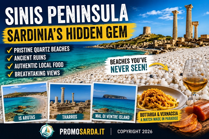
The Sinis Peninsula, on Sardinia’s central-western coast, is far more than a beach destination. Within a relatively small area, visitors can move between quartz beaches, limestone cliffs, wetlands populated by flamingos, archaeological sites spanning thousands of years, rural villages, historic fishing traditions and one of the most distinctive food cultures in western Sardinia.
To the west, the peninsula faces the open Sardinian Sea and the strong Maestrale winds. To the east, wetlands and lagoons dominate the landscape. At its southern end, Capo San Marco protects the remains of ancient Tharros, while inland lie Mont’e Prama, Sa Osa and San Salvatore di Sinis.
This combination makes the Sinis ideal for travelers looking for more than a conventional Mediterranean holiday. You can spend the morning exploring Phoenician and Roman ruins, swim from a quartz beach in the afternoon, watch flamingos over the Cabras lagoon before sunset and finish the day with bottarga and Vernaccia in the historic center of Cabras.
Much of the coastline is protected within the Sinis Peninsula – Mal di Ventre Island Marine Protected Area, helping preserve one of Sardinia’s most remarkable coastal environments.
The Sinis Peninsula at a Glance
| If you are looking for… | Best place to go |
|---|---|
| The most iconic beach | Is Arutas |
| A wilder quartz beach | Mari Ermi or Maimoni |
| Family-friendly shallow water | Putzu Idu |
| Archaeology by the sea | Tharros |
| Nuragic archaeology | Mont’e Prama |
| An unusual historic village | San Salvatore di Sinis |
| Panoramic hiking | Capo San Marco and Seu Oasis |
| Birdwatching | Cabras, Mistras and Sale ’e Porcus lagoons |
| Surfing | Capo Mannu |
| A boat excursion | Mal di Ventre Island |
| Traditional local food | Cabras |
| The most practical base | Cabras |
Where Is the Sinis Peninsula?
The Sinis Peninsula lies on the central-western coast of Sardinia, in the province of Oristano.
Cabras is the main gateway to the area and the most convenient base for exploring it. From the town, visitors can easily reach the western beaches, Mont’e Prama, San Salvatore di Sinis, San Giovanni di Sinis, Tharros and Capo San Marco.
The geography of the peninsula explains much of its character.
To the east are shallow lagoons and wetlands. To the west, the land meets the open Sardinian Sea. To the south, Capo San Marco separates the exposed western coastline from the calmer Gulf of Oristano.
Few places in Sardinia offer such contrasting landscapes within such short distances.
How to Get to the Sinis Peninsula
For visitors arriving by air, Cagliari-Elmas Airport is one of the most practical entry points.
The airport has its own railway station, and regional trains connect Cagliari-Elmas with Oristano. Depending on the service, some journeys take less than one hour.
From Oristano, travelers can continue towards Cabras and the Sinis Peninsula by road.
For visitors planning to explore several beaches, archaeological sites and rural areas in the same trip, renting a car remains the most convenient option.
Public transport is possible, particularly between Oristano and the main inhabited centers, but seasonal schedules should always be checked before departure.
How to Reach Is Arutas
From central Cabras, drive west towards the coast and continue along the provincial roads leading to the Sinis beaches.
Is Arutas is approximately 14 kilometers from Cabras, and the journey normally takes around 20 minutes by car.
During the busiest summer weeks, parking may be regulated or subject to fees. Arriving early in the morning is generally the best option if you want to enjoy the beach before peak visitor numbers.
How to Reach Tharros and San Giovanni di Sinis
From Cabras, follow the SP6 towards San Giovanni di Sinis.
The village is approximately 10 kilometers from Cabras. From the main parking area, both the archaeological site of Tharros and San Giovanni can be reached on foot.
Allow at least 90 minutes for Tharros if you want to explore the site without rushing.
If you also plan to walk towards the Torre di San Giovanni or Capo San Marco, set aside several hours.
The site is largely exposed to the sun, so during summer it is essential to carry water, sun protection and a hat.
How to Reach Mal di Ventre Island
Mal di Ventre Island cannot be reached by car.
Boat and RIB excursions usually depart from the northern Sinis coast, particularly from the Putzu Idu and Mandriola area.
Crossing times vary according to the boat and sea conditions.
The Maestrale wind plays an important role here. Even when the weather looks clear, sea conditions can make excursions uncomfortable or impossible, so departures should always be confirmed with the operator on the day of the trip.
Best Time to Visit the Sinis Peninsula
The best period depends on what you want from your trip.
May and June are excellent for combining beaches, hiking and archaeological visits without peak-summer crowds.
July and August offer classic beach weather but also bring higher temperatures, more traffic and busier parking areas.
September is especially attractive. The sea is still warm, visitor numbers begin to fall and Cabras hosts some of its most important traditional celebrations.
Spring and early autumn are particularly good for walking around Capo San Marco, Su Tingiosu and the Seu Oasis, as well as for exploring archaeological sites without the intense summer heat.
Whatever the season, the Maestrale must be taken seriously.
In the Sinis it is not merely a weather detail. It can determine which beach is comfortable, whether a boat trip is possible and whether conditions are suitable for surfing or wind sports.
Best Beaches in the Sinis Peninsula
The Sinis is famous for its quartz beaches, but the coastline is much more varied than the photographs of Is Arutas might suggest.
Within a relatively short distance, beaches differ in exposure, water depth, seabed, services and protection from the wind.
Is Arutas
Is Arutas is the best-known beach on the peninsula.
Instead of ordinary fine sand, the shore is formed by small rounded quartz grains. Their colors range from translucent white to pale pink, beige and soft green.
Under bright sunlight, the contrast between the quartz and the sea produces some of the most distinctive coastal colors in Sardinia.
The seabed includes both sandy and rocky sections, and the water can become deeper relatively quickly.
When the western coast is exposed to wind, conditions can also become rough.
Is Arutas should be treated as a fragile natural environment. Quartz, sand, shells and stones must not be removed from the beach.
Mari Ermi
Immediately north of Is Arutas, Mari Ermi shares the same quartz character but feels broader and less enclosed.
The surrounding landscape is more open, with wetlands and seasonal water areas behind the shore.
It is particularly attractive for travelers who prefer beaches that feel less developed and more exposed to the natural environment.
Mari Ermi is also popular with people interested in water sports, especially when wind conditions are favorable.
Portu Suedda
Further north, Portu Suedda continues the transition towards a quieter and less developed coastal landscape.
The area combines beach, dunes and wetlands and is especially appealing to travelers who prefer nature over organized beach facilities.
Because it is exposed to the wind, conditions can change quickly.
A day that is ideal for windsurfing may not necessarily be ideal for someone looking for calm swimming conditions.
Maimoni
South of Is Arutas, Maimoni is another long and attractive beach where light-colored sand mixes with quartz grains.
It generally feels more open and less concentrated than Is Arutas.
The Maestrale can be strong here, making the beach particularly dramatic on windy days.
Behind the shoreline, dune vegetation and Mediterranean scrub form an important natural buffer.
Visitors should use established access routes and avoid walking unnecessarily across the dunes.
Putzu Idu
In the northern part of the peninsula, Putzu Idu offers a different experience.
The beach forms a broad bay with finer sand and water that remains relatively shallow close to the shore.
For this reason, it is often considered one of the more convenient beaches for families.
Putzu Idu is also one of the most practical areas for boat excursions towards Mal di Ventre Island.
Continuing north towards Mandriola and Capo Mannu, the coastline becomes increasingly exposed to wind and waves.
S’Arena Scoada
S’Arena Scoada combines sand, limestone formations and clay-rich coastal sections.
The geological variety makes it visually different from the better-known quartz beaches.
Although visitors have traditionally used the natural clay as improvised skin treatments, it is better to leave rocks, clay and other natural materials undisturbed.
Which Sinis Beach Should You Choose?
| Beach | Best for | Character |
|---|---|---|
| Is Arutas | First-time visitors, photography | Iconic, popular |
| Mari Ermi | Nature and water sports | Open and wild |
| Maimoni | Space and quieter surroundings | Exposed and scenic |
| Putzu Idu | Families and services | Shallow water near shore |
| S’Arena Scoada | Geological variety | Sand, rock and limestone |
| Portu Suedda | Wind and unspoiled scenery | Less developed |
The Geology of the Sinis Coast
The physical landscape of the Sinis reflects millions of years of geological change.
The peninsula includes sedimentary, volcanic and metamorphic formations, making the coast particularly interesting for anyone interested in geology.
Around Capo San Marco, ancient limestone formations are associated with later volcanic activity.
Studies of Messinian deposits in the area have identified unusual carbonate structures formed by microbial communities, bryozoans and serpulids rather than by the classic coral reef systems found elsewhere in the Mediterranean.
This geological history gives another dimension to the landscape surrounding Tharros.
The cliffs and rock formations are not simply a scenic backdrop. They record marine environments that existed long before human settlement began.
Su Tingiosu Cliffs
North of Mari Ermi rise the white limestone cliffs of Su Tingiosu.
The cliffs reach approximately 25 meters in height and form one of the most dramatic stretches of coastline in the Sinis.
Small freshwater springs can emerge directly from the porous rock, while cracks and ledges provide habitat for numerous bird species.
The area is excellent for coastal walking and birdwatching, particularly outside the hottest summer months.
However, visitors should remain well away from cliff edges during windy weather and avoid attempting unmarked descents towards inaccessible coves.
Wetlands and Lagoons of the Sinis
Anyone who visits only the beaches sees only half of the Sinis.
The eastern side of the peninsula is dominated by an extensive system of lagoons and wetlands that are internationally important for biodiversity.
The best-known are:
- Stagno di Cabras
- Stagno di Mistras
- Stagno di Sale ’e Porcus
These areas are recognized under the Ramsar Convention.
The Cabras Lagoon covers approximately 3,575 hectares and is the largest lagoon in Sardinia.
Mistras covers approximately 680 hectares, while Sale ’e Porcus extends over roughly 330 hectares and is characterized by strong seasonal salinity.
These wetlands support flamingos, purple swamphens, herons, marsh harriers, ospreys and numerous migratory bird species.
They also play an essential economic role.
The Cabras lagoon has supported traditional grey mullet fishing for generations and remains inseparable from the history of local bottarga production.
The wider wetlands of the Gulf of Oristano have also been included in conservation and sustainable-management initiatives such as the Maristanis project.
For travelers, the best times to experience the lagoons are often early morning and late afternoon, when both wildlife activity and light conditions are at their best.
Mont’e Prama and the Giants
The discovery of Mont’e Prama transformed the understanding of Nuragic archaeology.
During agricultural work in the 1970s, fragments of monumental limestone statues began to emerge close to a necropolis.
Thousands of fragments were eventually recovered and reconstructed into large human figures traditionally divided into boxers, archers and warriors, together with stone models of nuraghi.
Their most recognizable features are the geometric eyes formed by concentric circles.
Today, the best way to understand Mont’e Prama is to combine two visits.
The Museo Civico Giovanni Marongiu in Cabras displays statues and archaeological finds from the territory.
The Mont’e Prama archaeological area allows visitors to see the landscape in which the necropolis and sculptures were originally found.
Seeing both places creates a far more complete experience than visiting the museum alone.
Sa Osa and the Origins of Viticulture
The archaeological site of Sa Osa has added another remarkable chapter to the history of the Sinis.
Waterlogged wells dating to the Middle and Late Bronze Age contained thousands of preserved grape seeds.
Researchers recovered around 15,000 uncharred grape pips, an exceptional level of preservation for archaeological plant remains.
Morphometric analyses suggest that some of the later samples were associated with early cultivated forms of Vitis vinifera.
These findings provide important evidence of grape cultivation in Sardinia during the Late Bronze Age.
Rather than simply claiming that Sa Osa proves “the first viticulture in the western Mediterranean,” it is more accurate to describe the site as one of the most significant early pieces of evidence for cultivated grape varieties in prehistoric Sardinia.
The discovery makes the modern relationship between the Oristano area and wine feel much older than the contemporary wine industry suggests.
Tharros: A Mediterranean City Through the Ages
At the southern edge of the peninsula, beneath Capo San Marco, lie the ruins of Tharros.
Few archaeological sites in Sardinia combine history and landscape so effectively.
The area was occupied before the Phoenician period, with evidence of Nuragic activity on the promontory.
Phoenician presence is documented from the 8th century BCE, while the development of the urban settlement is generally associated with the later 7th century BCE.
Tharros subsequently passed through Punic, Roman, Late Antique and Byzantine phases.
Today, much of what visitors see belongs to the Roman city.
Basalt-paved streets, bath complexes, residential structures, water infrastructure and monumental remains reveal a substantial urban center.
The Roman aqueduct supplied a distribution system that served both the population and the thermal complexes.
On the hill of Su Muru Mannu lies the area traditionally identified as the Phoenician-Punic tophet.
What makes Tharros especially fascinating is not one single period, but the overlapping layers of Mediterranean history.
Different communities repeatedly used and transformed the same strategic coastal location.
During the Middle Ages, Tharros also played an important role in the early history of the Judicate of Arborea, before the political center eventually moved inland to Oristano.
How Long Do You Need at Tharros?
For a relaxed visit, allow approximately 90 minutes.
Visitors who want to continue towards the Torre di San Giovanni or walk further along Capo San Marco should reserve several hours.
Opening times vary during the year, so checking the official site before visiting is recommended.
Church of San Giovanni di Sinis
Just before reaching Tharros stands the Church of San Giovanni di Sinis, one of the most important early medieval religious buildings in Sardinia.
Its architectural history is more complex than a single foundation date might suggest.
The present building preserves evidence of different construction phases associated with Paleochristian, Byzantine and early Romanesque traditions.
Several structural elements are generally dated to around the 10th and 11th centuries.
Some of the sandstone blocks used in the church were reused from the nearby settlement of Tharros.
Inside, the atmosphere is austere and quiet.
The contrast between the dim interior and the brilliant coastal landscape outside makes the church one of the most memorable stops between San Giovanni and Tharros.
San Salvatore di Sinis: Underground Sanctuary and Western Film Set
A few kilometers inland from Cabras lies San Salvatore di Sinis, one of the most unusual villages in the area.
The small settlement includes traditional cumbessias, simple houses historically used by pilgrims during religious novenas.
At the center stands the 17th-century Church of San Salvatore.
Its greatest surprise is underground.
Beneath the church lies the Hypogeum of San Salvatore, a subterranean sacred complex used and reinterpreted over different periods.
Its walls preserve Punic, Greek, Latin and Arabic inscriptions, together with paintings and symbols belonging to different religious traditions.
Among the documented subjects are Hercules, Pegasus and other figures associated with the classical world.
Later Christian elements and Arabic inscriptions testify to the continued use and reinterpretation of the site.
San Salvatore also has a completely different chapter in its history.
During the late 1960s and following years, the village was transformed into a film set for a number of Spaghetti Westerns.
The 1968 film Giarrettiera Colt is among the productions associated with the village.
This unlikely combination of sacred site, pilgrimage settlement and Western film location makes San Salvatore one of the most distinctive places in the Sinis.
Hiking to Capo San Marco
Anyone visiting Tharros should consider continuing towards Capo San Marco.
The promontory forms the southernmost section of the peninsula and provides one of the best viewpoints in the entire Sinis.
From here, visitors can understand the geography of the landscape almost immediately.
On one side lie the more protected waters of the Gulf of Oristano.
On the other, the coastline opens towards the Sardinian Sea.
The route passes historic coastal towers and eventually leads towards the lighthouse.
The landscape is largely exposed, with little natural shade.
Spring, early summer and autumn are generally more comfortable for walking than the hottest weeks of July and August.
Seu Oasis
Between Funtana Meiga and Maimoni lies the Seu Oasis, a coastal promontory covered in Mediterranean scrub.
Walking trails pass through rosemary, lentisk, dwarf palms and other typical coastal vegetation.
The route leads towards small coves such as Seu and Is Caogheddas and passes close to the Torre del Sevo.
Compared with Capo San Marco, Seu feels quieter and more enclosed.
Spring is especially beautiful, when vegetation is greener and temperatures are ideal for walking.
Mal di Ventre Island
Approximately five nautical miles off the Sinis coast lies Mal di Ventre Island, also known locally as Malu Entu.
The island is uninhabited, rocky and almost entirely free of tourist infrastructure.
Together with the nearby Catalano rock, it forms one of the most protected areas within the Sinis marine reserve.
The island should therefore not be approached as an offshore beach resort.
Visitors should come prepared with drinking water, sun protection and everything needed for the day.
Shade is limited and landing conditions depend on the sea.
The surrounding waters are particularly interesting for marine biodiversity and underwater archaeology.
Roman shipwreck material and other archaeological finds associated with the waters around Mal di Ventre are also represented in the collections of the Cabras museum.
For most visitors, joining an authorized excursion is the easiest and most responsible way to experience the island.
Capo Mannu: Surf and the Maestrale
At the northern end of the wider Sinis area, Capo Mannu is one of Sardinia’s best-known locations for surfing and wind sports.
The promontory is highly exposed to weather systems approaching from the west and northwest.
When swell and wind are strong, some surf spots are suitable mainly for experienced riders.
Beginners may find more manageable conditions around the protected bays near Putzu Idu, where local schools and activity providers operate.
The key rule is simple: in the Sinis, wind conditions should influence your daily itinerary.
Choosing the right beach according to the wind can make the difference between an excellent day and an uncomfortable one.
Sinis Peninsula Itinerary: 1, 2 or 3 Days
One Day in the Sinis
If you only have one day, focus on the southern section:
Cabras → Giovanni Marongiu Museum → San Giovanni di Sinis → Tharros → Capo San Marco
If time allows, finish the day with sunset at Is Arutas.
Two Days in the Sinis
On the second day, explore the central coastline:
Is Arutas → Mari Ermi → Maimoni → San Salvatore di Sinis
This gives you a balanced combination of beach, landscape and cultural history.
Three Days in the Sinis
With three days, add the northern section or a boat excursion.
Depending on sea conditions, choose between:
Mal di Ventre Island
or
Putzu Idu → Capo Mannu → Sale ’e Porcus → Su Tingiosu
Travelers more interested in nature can spend additional time in the wetlands and Seu Oasis.
Those focused on archaeology can devote more time to Mont’e Prama and the Cabras museum.
Where to Stay in the Sinis Peninsula
For most visitors, Cabras is the most practical base.
It offers restaurants, services and evening life while remaining close to both the beaches and the archaeological sites.
Aquae Sinis Albergo Diffuso is an unusual option because its rooms are located in restored historic buildings around central Cabras rather than inside one conventional hotel.
For a quieter countryside location between Cabras and the coast, Sa Pedrera Country Hotel is positioned along the road towards San Giovanni di Sinis.
Travelers looking for a more rural stay can consider Agriturismo S’Incant’e Sinis.
The location you choose is ultimately more important than the specific hotel.
Stay in Cabras if you want restaurants, services and easy access in several directions.
Choose San Giovanni di Sinis or Funtana Meiga if being close to the sea is your priority.
Choose Putzu Idu if you mainly intend to explore the northern coast, Capo Mannu and Mal di Ventre.
Where to Eat in Cabras and the Sinis
Eating in the Sinis means understanding the relationship between Cabras and its lagoon.
For a more contemporary dining experience, Terracrua Restaurant is one of the options in central Cabras.
For traditional seafood and local dishes, Trattoria Sa Bell’e Crabasa is another well-known address.
A different experience is connected with Peschiera Mar’e Pontis, the historic lagoon fishery.
More than simply a restaurant location, Mar’e Pontis represents the traditional fishing culture of Cabras.
Experiences, opening periods and food services may change seasonally, so checking directly before visiting is advisable.
What to Eat in the Sinis
Bottarga di Muggine
The product most closely associated with Cabras is grey mullet bottarga.
Bottarga is made from the roe sacs of female grey mullet, which are salted, pressed and dried.
It can be sliced thinly and served with olive oil or grated over pasta.
One of the most natural combinations is with fregula and seafood.
An important distinction is worth understanding.
Bottarga processed in Cabras is not necessarily produced from grey mullet caught in the Cabras lagoon.
Local initiatives and Slow Food protection increasingly focus on preserving the traditional product linked specifically to fish caught in the lagoon itself.
For visitors buying bottarga, provenance is therefore worth checking.
Sa Merca
Sa Merca is one of the dishes most strongly connected to the traditional fishing culture of Cabras.
Grey mullet is boiled in salted water and then traditionally wrapped in the leaves of a local marsh plant known as sa zibba.
The plant helps preserve the fish and contributes to its distinctive aroma.
Sa Merca is more than a recipe.
It reflects an older system in which fishing, lagoon vegetation and food preservation were all connected.
Other Sardinian Dishes to Try
Visitors will also find broader Sardinian classics throughout the area.
These include:
- Malloreddus alla Campidanese – small semolina pasta with sausage and tomato sauce
- Porceddu – traditional roast suckling pig
- Seadas – fried pastry filled with cheese and usually served with honey
These dishes are not exclusive to the Sinis, but they fit naturally into a food-focused journey through western Sardinia.
Vernaccia di Oristano
The other great regional product is Vernaccia di Oristano DOC.
This wine is known for its distinctive oxidative aging process.
Barrels may be left partially unfilled, allowing a natural layer of yeast known as flor to develop on the surface of the wine.
This contributes to aromas of dried fruit, nuts, spices and saline notes.
Cabras is home to Cantina Contini, founded in 1898 and historically associated with Vernaccia production.
Some Vernaccia wines undergo very long aging periods in partially filled oak and chestnut barrels.
Bottarga and Vernaccia come from different environments — lagoon and vineyard — yet both express the same territory through salinity, wind and traditional preservation techniques.
The Corsa degli Scalzi
One of the most important traditions in Cabras is the Corsa degli Scalzi, or Barefoot Race.
At dawn, hundreds of barefoot runners known as Curridoris, dressed in white, carry the sacred image of San Salvatore from Cabras to the village of San Salvatore di Sinis.
The statue returns the following day.
The tradition is associated with the historic memory of coastal raids and has become one of the strongest expressions of community identity in Cabras.
For travelers, the event offers a very different perspective on the Sinis.
This is not a festival created for tourism.
It is first and foremost a religious and community tradition.
Visitors should therefore attend respectfully and remember that accommodation in Cabras can become scarce during the festival weekend.
Bottarga Festival
September also brings celebrations dedicated to another symbol of Cabras: bottarga.
The Bottarga Festival typically includes tastings, food events, workshops, demonstrations, cultural activities and discussions connected with the lagoon economy.
The event is useful for understanding bottarga beyond its luxury-food image.
Behind the product lies a wider system involving fishermen, lagoon ecology, traditional processing methods and the economic history of Cabras.
Healthcare and Useful Services
The main hospital serving the area is San Martino Hospital in Oristano.
For serious emergencies, visitors should use the standard emergency services.
Seasonal tourist medical services are often activated in coastal locations around the Oristano area during summer, including areas such as Torre Grande, Putzu Idu and Santa Caterina di Pittinuri.
Because opening periods and locations can change from one season to another, current information should always be checked before relying on a specific facility.
Cabras and Oristano also have pharmacies and standard territorial healthcare services.
Renewable Energy and the Future of the Sinis Landscape
The Sinis is also part of a wider debate about renewable-energy development in Sardinia.
Several large wind and solar projects have been proposed across the island and offshore areas.
One project associated with the waters west of Sardinia is the Mistral offshore wind farm, designed around a group of large floating wind turbines.
The project has generated debate between supporters of renewable-energy expansion and groups concerned about environmental, landscape and infrastructure impacts.
This is a subject that should be treated carefully.
Project status, turbine numbers, approval procedures and environmental assessments can change over time.
For this reason, any travel or informational article discussing the project should clearly distinguish:
- confirmed project characteristics;
- current administrative status;
- arguments made by the developer;
- concerns raised by environmental groups and local communities.
Avoiding exaggerated language makes the section both more reliable and more useful.
Responsible Tourism in the Sinis
The Sinis remains beautiful because much of it is still environmentally fragile.
A few basic rules make a significant difference:
- do not remove quartz, sand, shells or rocks;
- avoid walking on protected dunes;
- use established paths;
- do not leave waste;
- do not disturb nesting or feeding birds;
- respect the rules of the Marine Protected Area;
- follow navigation and anchoring restrictions around Mal di Ventre.
Responsible tourism does not reduce the quality of the experience.
It helps ensure that the qualities visitors come to see remain intact.
Frequently Asked Questions About the Sinis Peninsula
What Is the Most Beautiful Beach in the Sinis?
Is Arutas is the most famous, especially because of its quartz grains.
However, the best beach depends on what you want.
Mari Ermi feels wilder, Maimoni offers more space and Putzu Idu is often more convenient for families.
How Many Days Do You Need for the Sinis Peninsula?
One day is enough for Tharros, San Giovanni and one beach.
Two days allow you to add Mont’e Prama, San Salvatore and more of the coast.
Three days provide a much more complete experience and make it possible to include Mal di Ventre or the northern Sinis.
Is Cabras or the Coast Better for Accommodation?
Cabras is the best choice for travelers who want restaurants, archaeological sites, beaches and services within easy reach.
Staying directly on the coast is better if swimming and beach time are your main priorities.
Can You Visit the Sinis Without a Car?
Yes, but it requires more planning.
Oristano is accessible by train, including from Cagliari-Elmas Airport, and regional buses serve parts of the area.
However, a car makes it considerably easier to combine beaches, Mont’e Prama, Tharros and the northern peninsula.
How Do You Get to Mal di Ventre Island?
The island is accessible only by sea.
For most visitors, the easiest option is to join an organized excursion from the Putzu Idu or Mandriola area.
Where Can You See the Giants of Mont’e Prama?
The reconstructed statues can be seen at the Museo Civico Giovanni Marongiu in Cabras.
Visitors can also explore the Mont’e Prama archaeological area where the necropolis and sculptures were discovered.
What Should You Absolutely Not Miss in the Sinis?
For a first visit, prioritize:
Is Arutas, Tharros, Mont’e Prama, the Giovanni Marongiu Museum, San Giovanni di Sinis, San Salvatore and Capo San Marco.
With additional time, add Mal di Ventre, Mari Ermi and the wetlands.
Why the Sinis Peninsula Is Worth Visiting
The greatest strength of the Sinis Peninsula is not one beach or one archaeological site.
It is the concentration of completely different experiences within a very small area.
In the morning, you can walk along the ancient streets of Tharros.
By lunchtime, you can be swimming from a quartz beach.
Later, you can watch flamingos over a lagoon or stand in front of the monumental figures of Mont’e Prama.
In the evening, the landscape returns to the table through mullet, bottarga and Vernaccia.
The history of the Sinis stretches from the Bronze Age through Phoenician trade, Punic settlement, Roman urban culture, Byzantium and the Middle Ages.
Its landscape brings together quartz, limestone, granite, wetlands, Mediterranean scrub and open sea.
Its food traditions remain closely connected to fishing, wine, salt and wind.
That combination — rather than any single tourist attraction — is what makes the Sinis Peninsula one of the most rewarding destinations in western Sardinia.