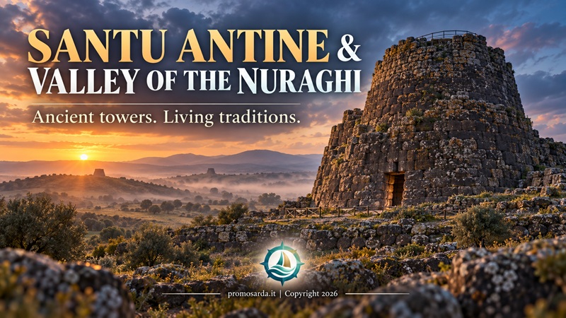
One of Sardinia’s greatest nuraghi, Nuraghe Oes, Torralba’s archaeological museum and a Bronze Age landscape packed with towers, villages and Tombs of Giants
Some archaeological monuments are impressive because somebody tells you they are important. Santu Antine does not need much help. The central tower rises from the Cabu Abbas plain near Torralba, and once you walk inside the monument its exterior mass becomes even more surprising: corridors run through the thickness of the masonry, stairways climb between levels, towers communicate through galleries and the entire structure reveals a degree of planning that photographs rarely communicate properly.
But Santu Antine makes most sense when you stop treating it as one exceptional tower. It stands inside the Valley of the Nuraghi, where regional tourism documentation identifies around 30 nuraghi and ten Tombs of Giants within approximately 37 km².
One nuraghe is architecture. Thirty begin to describe a territorial system.
If you are travelling across Northern Sardinia, use this article as the detailed Meilogu chapter of our Northern Sardinia Archaeology Road Trip. For the much older rock-cut funerary landscape around nearby Bonorva and Cheremule, continue with our Domus de Janas in Northern Sardinia — UNESCO guide.
Santu Antine at a Glance
| Practical detail | Current information |
|---|---|
| Location | Cabu Abbas plain, Torralba |
| Monument type | Trilobed complex nuraghe + village |
| Chronology | Middle Bronze Age → Iron Age, later reuse |
| Central tower | 17.55 m surviving height |
| Original central tower | Probably around 23–24 m |
| Valley density | ~30 nuraghi + 10 Tombs of Giants / 37 km² |
| Current summer hours | 09:00–20:00 |
| Current winter hours | 09:00–17:00 |
| Admission | Paid; verify current live tariff |
| Guided visits | Listed, including English/French; confirm availability |
| Museum | Separate; €6 full / €4 reduced, advance arrangement |
| Oes | Free, unmanaged, ~700 m walk |
| UNESCO World Heritage? | No — Tentative List |
Current regional records were updated in April 2026 and advise checking the Santu Antine visitor service directly for the latest site tariff and access details. The official regional listing confirms guided visits, audioguide services, Wi-Fi and a refreshment point.
The Main Archaeological Area
What Is the Valley of the Nuraghi?
The Cabu Abbas plain lies in Meilogu, a landscape shaped by ancient volcanic geology and exceptionally dense prehistoric occupation. Around Torralba, regional tourism information records 30 nuraghi and ten Tombs of Giants within 37 square kilometres.
That concentration is more useful than the marketing name itself. It tells us the area supported a highly organised Bronze Age settlement landscape rather than one isolated monumental centre.
When you arrive at Santu Antine, look across the plain before going inside.
Then look again when you leave.
The second view is better because now you know what you are looking for.
1. Santu Antine – Sa Domu de su Re
The monument is popularly known as Sa Domu de su Re — “the House of the King.” The name reflects its extraordinary scale and later local tradition; it does not prove that a Bronze Age king literally lived there.
The surviving central tower measures 15.5 metres in diameter and 17.55 metres high. It originally had three floors and a terrace and is estimated to have reached roughly 23–24 metres. Around it stands a trilobed bastion with three secondary towers connected by long internal galleries.
The safest chronology is broad: the complex developed through several phases from the Middle Bronze Age into the Iron Age, followed by reuse during later historical periods.
That wording is better than pretending one exact construction date explains a monument that changed over centuries.
Basalt and Engineering
Santu Antine is built from basalt. Large roughly worked blocks dominate the lower levels, while masonry becomes more regular and refined higher up. The central tower contains a tholos chamber, stairways and passages built within exceptionally thick walls. The bastion galleries extend for around 23 metres and are lit by multiple narrow openings.
This is where “primitive architecture” stops being a useful expression.
Dry-stone masonry.
Multiple levels.
Internal circulation.
Load distribution.
Lighting.
Staircases.
A surviving tower seventeen metres high.
Whatever interpretation you prefer for the monument’s function, the engineering is not ambiguous.
Inside Santu Antine
The interior is the reason I would never recommend stopping at the exterior viewpoint. Corridors run around chambers; spiral stairways rise through the central tower; galleries connect secondary towers; wells and subsidiary rooms are built inside the bastion.
The monument feels much larger internally than its external silhouette suggests because so much usable architecture exists inside the thickness of the walls.
Gavino’s advice: stop photographing for two minutes inside one of the galleries. Look at the light. Look at the masonry. Look at how the route turns. Ask yourself how the building felt before electric torches, visitor signage and safety rails.
That is when the architecture works.
The Courtyard
The internal courtyard functions as the distribution point of the complex, with several openings connecting the central and secondary structures. A well also forms part of this internal space. Current local interpretation describes seven monumental access points around the courtyard.
Stand there and rotate slowly.
It is probably the easiest place to understand how the different parts of the nuraghe relate to each other.
Fortress, Residence, Symbol – What Was Santu Antine For?
Older interpretations often describe complex nuraghi as fortresses or castles. Defensive characteristics are obvious enough: huge walls, controlled access and strategic placement.
But that may not be the entire story.
Complex nuraghi could have combined territorial, residential, social, political, storage and symbolic functions, and those functions may have changed through time.
I prefer not to reduce a monument used for centuries to one modern noun.
A building can do more than one job.
Bronze Age buildings were presumably aware of this too.
The Village Outside
Santu Antine was not an isolated tower in an empty field. Outside the monument, excavations have exposed 14 circular Nuragic huts, alongside rectangular structures from later Roman occupation. Regional tourism material notes that the excavated settlement may represent only about a tenth of its original extent.
This changes the visitor’s mental picture immediately.
A large community existed around the monumental centre.
The village includes structures interpreted as houses, workshops and public spaces, including the so-called meeting hut.
Once the village enters the story, the question stops being “Who lived in the tower?”
It becomes “How did this entire community work?”
Better question.
Metal, Trade and the Bronze “Breads”
A deposit of bronze ingot-like material, often called pani di bronzo, was found near the western tower and is now associated with the archaeological collections in Sassari.
Metal matters because it reminds us that a stone monument belonged to a wider technological and exchange network. Copper, tin, metallurgy and specialised tools connect Nuragic communities to economic systems extending beyond one valley.
Island does not mean isolated.
Roman Reuse
Later Roman occupation introduced rectangular buildings over and around parts of the earlier Nuragic village. Regional sources describe a Roman agricultural settlement or villa developing in the area and continuing for centuries.
This is one of my favourite details.
The Romans did not arrive in an empty landscape.
They arrived beside structures already ancient.
Santu Antine had history before Rome had history here.
2. Nuraghe Oes – Do Not Ignore the Neighbour
Nuraghe Oes lies in Giave territory, very close to Santu Antine, and is one of the best comparisons you can make after visiting the main monument.
Its architecture is unusual because evidence suggests that some tall internal chambers originally used wooden intermediate floors supported by ledges and beam holes. Stone survives. Timber disappears. That means the interior of a prehistoric structure could originally have looked considerably more complex than the remaining masonry suggests.
The latest national cultural-heritage database describes Oes as an unmanaged, free-access site, reached by approximately 700 metres of walking from the Torralba railway-station side. There is no dedicated parking at the monument, and the route is classified as medium difficulty.
Because excavation and conservation work continues periodically in this archaeological landscape, check locally for temporary restrictions before setting out.
Gavino Wouldn’t Do This
I would not cross railway infrastructure wherever my GPS draws the shortest line.
Use the legitimate approach.
The shortest distance between two points is not automatically public access.
3. Museo della Valle dei Nuraghi
Torralba’s Museo della Valle dei Nuraghi del Logudoro-Meilogu contains material from Santu Antine and the wider territory, including archaeological and ethnographic collections, a model of the monument, metallurgical objects, a fragmentary nuraghe model and a small bronze dog figure.
The practical point is important: the regional cultural database, updated 30 April 2026, currently lists the museum as accessible by advance arrangement, contacting the Santu Antine visitor centre beforehand. Current museum admission is €6 full / €4 reduced.
Do not assume it keeps ordinary all-day museum hours.
Call.
Current shared contacts include +39 079 847481, +39 334 1953870 and nuraghes.antine@tiscali.it.
Current 2026 Santu Antine Hours
The current local territorial visitor portal lists 09:00–20:00 during the summer season, from the last Saturday of March to the last Sunday of October, and 09:00–17:00 during winter.
For September 2026, 09:00–20:00 is therefore the relevant published schedule.
The regional heritage portal still recommends checking the site’s own current information before travelling, which is sensible advice for any attraction with seasonal services.
Current Ticket Price: Be Careful With Old Pages
The regional cultural portal confirms that Santu Antine is paid admission but deliberately directs visitors to the monument’s live website for the current tariff rather than preserving an old price in its database.
Current visitor listings commonly place adult admission around €10, so I would budget approximately that amount, but confirm before arrival.
More importantly: do not confuse the archaeological-site ticket with the museum ticket. The museum is currently separately listed at €6 full price and requires advance arrangement.
That is the correction I would want published clearly.
Guided Visits
The regional heritage portal lists guided visits in English and French, along with a multilingual audioguide app.
I would still confirm guide availability for the specific date and time you plan to visit rather than assume every entry automatically includes a live guide.
If one is available, take it.
The architecture deserves explanation.
Is Santu Antine UNESCO World Heritage?
No.
Santu Antine is included in Italy’s serial proposal “Nuragic monuments of Sardinia”, submitted to the UNESCO Tentative List in 2021. It appears as one of the representative monuments in that proposal.
Tentative List is not the same as World Heritage inscription.
Su Nuraxi at Barumini is already inscribed separately; Santu Antine currently remains part of the broader proposed Nuragic serial property.
So the accurate description is:
UNESCO Tentative List site.
Not:
UNESCO World Heritage Santu Antine.
Santu Antine vs La Prisgiona
This comparison is useful if you are travelling through Northern Sardinia.
Santu Antine is the stronger architectural experience. La Prisgiona is the stronger settlement experience.
At Santu Antine, I remember the vertical tower, galleries and internal complexity.
At La Prisgiona, I remember how the central monument relates to an extensive excavated village.
If Gallura is part of your itinerary, our Arzachena Archaeological Park guide covers La Prisgiona and the surrounding prehistoric landscape.
The Valley Is Older Than the Nuraghi
The name “Valley of the Nuraghi” can make the entire territory sound Bronze Age.
It is not.
Nearby Sant’Andrea Priu at Bonorva and the Cheremule Petroglyph Park belong to much earlier funerary traditions and are part of the 2025 UNESCO domus de janas serial property.
This gives you one of the best chronological road trips in Northern Sardinia:
prehistoric rock-cut tombs → monumental Nuragic architecture → Roman reuse → medieval religious landscape.
Our Domus de Janas in Northern Sardinia — UNESCO guide goes into those earlier sites in detail.
A Good One-Day Itinerary
I would start with Santu Antine at 09:00, spend at least 90 minutes there, then visit Nuraghe Oes only if access conditions are suitable. After lunch in Torralba, visit the museum if you have arranged access. If energy and opening times still work, finish with Sant’Andrea Priu rather than trying to add three more nuraghi.
One proper day is better than eight archaeological parking lots.
A Better Two-Day Itinerary
Day 1: Santu Antine → Oes → Torralba museum. Use the remaining time to explore Meilogu slowly rather than collecting monuments.
Day 2: Cheremule → Sant’Andrea Priu → San Pietro di Sorres.
Now you have prehistoric tombs, Bronze Age monumental architecture, later reuse and medieval Sardinia.
That is a coherent cultural trip.
Best Time to Visit
My favourite months are April–June and September–October. The Cabu Abbas plain is exposed, so summer heat matters, although the interior of the nuraghe provides some shelter.
In July and August, start early.
Winter is also good on stable days, with greener landscape, lower light and far fewer visitors. Current winter opening is listed as 09:00–17:00.
Children, Footwear and Claustrophobia
Santu Antine works very well for children because it feels physical: corridors, stairs, towers and village structures are easier to understand than fragments inside a display case.
Comfortable shoes with proper grip are enough for the main managed site. For Oes, wear actual walking shoes.
Some internal corridors and stairs are narrow and dark. If enclosed spaces bother you, tell the staff or guide. There is no award for completing every passage.
The exterior, courtyard and village already give you plenty.
Archaeological Works Are Part of the Story
Santu Antine and neighbouring monuments remain active subjects of archaeological research and conservation. That means visitor routes can occasionally change and future excavations may alter current interpretation.
This is not inconvenient archaeology.
It is living archaeology.
A monument that continues generating research is healthier than one treated as a finished exhibit.
Do Not Turn Hypotheses Into Facts
Santu Antine attracts theories about kingship, defence, astronomy and wider territorial organisation.
Some may be interesting.
Not all are equally supported.
My rule remains simple:
a hypothesis should remain a hypothesis until the evidence earns stronger language.
The monument is already extraordinary without needing to reproduce the Pleiades or hide an ancient secret civilisation.
Getting There
From the SS131 Carlo Felice, use the Torralba exit and continue towards the SP21/local road network. The monument becomes visible across the plain before you reach the archaeological area. Regional tourism guidance places it around four kilometres from Torralba.
Normal road access reaches Santu Antine.
No 4×4 necessary.
Again my vehicle is denied drama.
Leave It Better
Managed archaeological sites make responsible behaviour obvious.
Secondary rural monuments require more discipline, not less.
Do not move stones.
Do not pick up pottery.
Do not cross excavation barriers.
Do not leave rubbish.
And if modern litter is beside a legitimate visitor route and I can remove it safely, it normally returns to the car with me.
Bronze Age communities have already contributed enough material to the archaeological record.
Plastic bottles are not required.
Santu Antine FAQ
What is Santu Antine? One of Sardinia’s major complex nuraghi, with a central tower, trilobed bastion, internal galleries, courtyard and surrounding settlement.
How old is it? The main architectural development runs from the Middle Bronze Age into the Iron Age, followed by historical reuse.
How tall is the tower? The central tower survives to 17.55 metres and probably originally reached roughly 23–24 metres.
How many nuraghi are in the valley? Regional tourism material identifies about 30 nuraghi and ten Tombs of Giants within 37 km².
Is Santu Antine UNESCO? It is on UNESCO’s Tentative List, not currently an inscribed World Heritage Site.
What are current opening hours? Summer 09:00–20:00; winter 09:00–17:00 according to the current territorial visitor portal.
How much does Santu Antine cost? The official regional database confirms paid admission but recommends checking the live current tariff. Budget roughly €10 based on current visitor listings and verify before travelling.
Does the museum use the same ticket? Do not assume so. The museum is currently listed separately at €6 full / €4 reduced and requires advance arrangement.
Are guided visits available? They are listed, including English and French, but confirm availability for your date and time.
Is Nuraghe Oes free? The current national heritage record lists Oes as free and unmanaged, reached by roughly 700 metres of walking.
How long should I spend at Santu Antine? At least 90 minutes; two hours is better with interpretation and village exploration.
Final Thoughts: One Nuraghe Is a Monument. The Valley Is the Story.
Santu Antine is easy to admire.
The harder part is understanding why it stands where it does.
Visit the galleries.
Climb the permitted staircase.
Walk through the village.
Then leave the monument and look across Cabu Abbas.
Oes is nearby.
Other towers occupy the wider landscape.
Tombs survive among the same fields.
Older domus de janas exist only a short drive away.
Santu Antine stops being a lonely masterpiece and becomes part of a densely inhabited prehistoric territory.
That is the better experience.
The trail is the spine; the territory is the story.
Here, the territory is the real monument.
